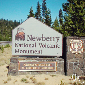
Newberry National Volcanic Monument in Oregon
Central Oregon’s landscape is very different than that of the Northwest part, where we live. It is considered high dessert, has dry summer’s and snowy winters. The area is dominated by volcanic activity with craters, cinder cones, and piles of lava rock.
A great place to see all this volcanic action is Newberry National Volcanic Monument in the Deschutes National Forest near Bend and Sunriver.
This post may contain affiliate links. When you make a purchase using one of these affiliate links, we get paid a small commission at no extra cost to you.
You can view all these sites in one day or spend many days exploring the area more intently.
Entrance Fee: $5/car. Both the Northwest Forest Pass and the America the Beautiful Pass are accepted. click here to see current fee pricing
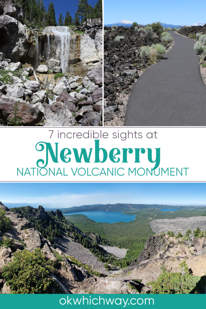
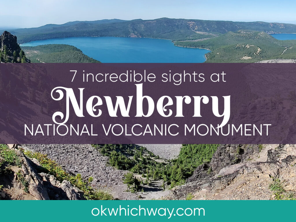
7 INCREDIBLE SIGHTS AT NEWBERRY NATIONAL VOLCANIC MONUMENT
After multiple attempts, the region finally became recognized as Newberry National Volcanic Monument in 1990. It is a volcanic area east of the Cascade mountain range that is managed by the U.S. Forest Service.
There are a number of incredible things to see within this national monument including cinder cones, a mile long lava tube, and a double waterfall. The most incredible, though, is a caldera from a volcano that was the size of Rhode Island. As opposed to a typical volcano with a cone shape, the Newberry Volcano was shaped like a broad shield due to multiple eruptions. Thermal vents and hot springs have geologists believing Newberry continues to be a very active volcano.
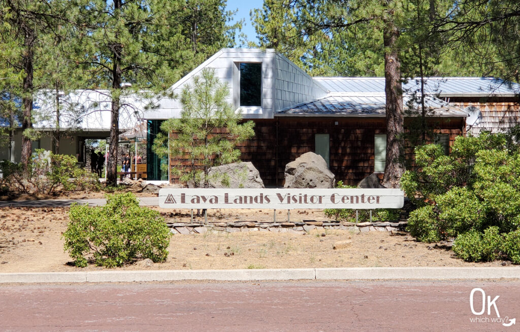
LAVA LANDS VISITOR CENTER
Whenever possible, my first stop at National Park Service sites is a visitor center. It helps get my bearings of an area and gives me the opportunity to ask any questions I may have. It’s also the place I stamp my passport book.
The Lava Lands Visitor Center has many exhibits on the geology of the Newberry Volcano, as well as the Cascade Mountain Range.
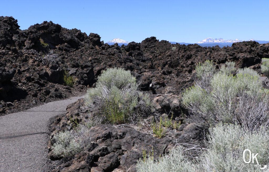
Near the visitor center are two paved trails, the Trail of the Whispering Pines and the Trail of the Molten Land. The Trail of the Molten Land is definitely worth exploring if you have the time. It’s a mile walk through a huge field of basalt lava with views of Mount Bachelor, Broken Top, and the Three Sisters. Keep in mind, though, on a hot summer’s afternoon – there is no shade along the trail. The Whispering Pines trail is .3 miles and meanders through ponderosa pines at the bottom of the lava flow. You can easily walk this trail as you head back to the parking lot.
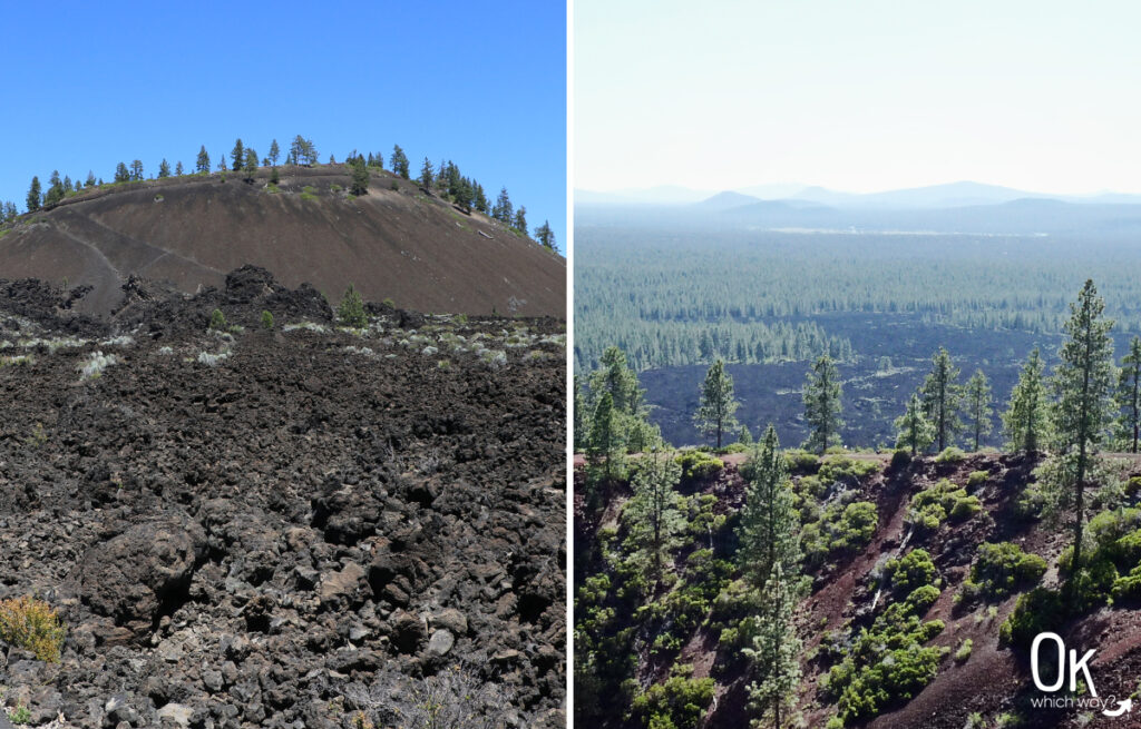
LAVA BUTTE
Located directly behind the visitor center is Lava Butte, a 500 foot high cinder cone. From the Visitor Center, you can catch a shuttle (for a couple bucks) to the top. The vantage point offers views of the Cascades, Newberry Caldera, and the large lava field below.
CINDER CONE
a conical volcano with a low, steep profile, having been formed mostly by the cinders or scoria that fall from lava that has violently spewed into the air and broken into fragments. Cinder cones are often found on the flanks of shield volcanoes, stratovolcanoes, and calderas. – dictionary.com
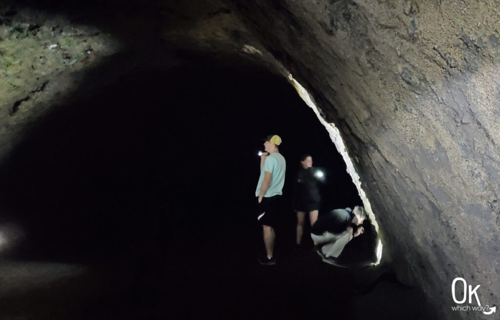
LAVA RIVER CAVE
Located just a couple minutes from the Visitor Center is Lava River Cave. It is a mile long and the longest lava tube in Oregon. When walking through Lava River Cave, you are walking through a tube that once had molten lava flowing through it.
A few things to keep in mind when walking through the tube:
It’s dark – bring 2 sources of light other than the flashlight on your phone
It’s chilly – the average temperature is 42 degrees inside the cave, so wear a jacket
It’s natural – the ground is uneven, so watch your step and wear decent shoes
It’s seasonal – plan accordingly, the cave is only open mid-May thru mid-September
It’s amazing – I highly recommend it
As of August 2022, reservations are now needed to enter the cave. It’s understandable. It’s a popular spot and often traffic would be backed up on the road.
LAVA CAST FOREST
About a half an hour’s drive from the visitor center is Lava Cast Forest. Walk the 1 mile interpretive trail to get up close to the geological wonders formed by fluid lava. 7,000 years ago this molten lava surrounded trees, forming molds around the trees as it cooled. The trees burned, leaving the insides hollow.
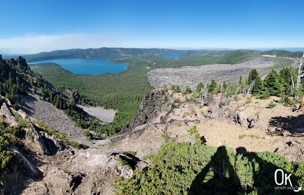
PAULINA PEAK
A drive up a curvy, steep road to Paulina Peak Overlook takes you to the highest point of the Newberry Volcano where you are rewarded with a 360° panoramic view. It is amazing!
The focal point is gazing into the 4×5 mile wide Newberry Caldera, with Paulina Lake, East Lake, Little Crater, and the Big Obsidian Flow. After Newberry Volcano collapsed a lake was created. Eruptions after this produced the 700 foot central cinder cone, known as Little Crater, that now separates the two lakes. The Big Obsidian Flow is the youngest lava flow in Oregon and consists of pumice and obsidian.
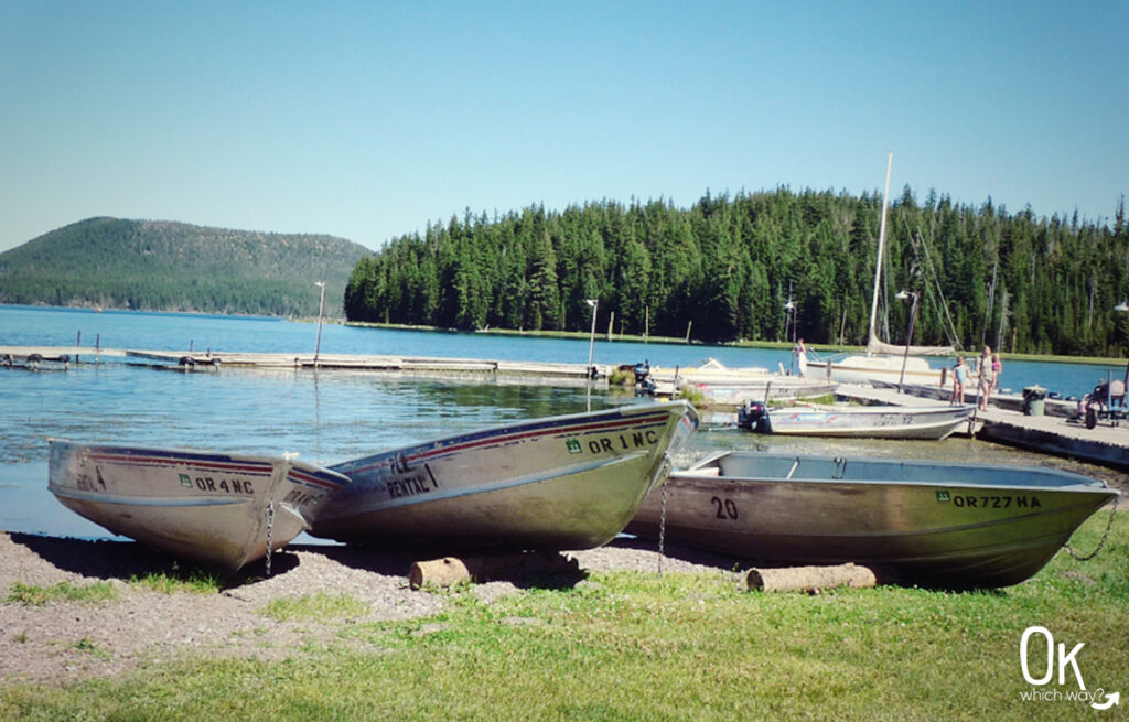
PAULINA LAKE & EAST LAKE
Both Paulina Lake and East Lake are great places to visit. They offer day use areas, boating, fishing, hiking and camping.
Paulina Lake is the deeper of the two lakes, at a maximum depth of 250 feet. Neither lake have streams flowing into them, so they are filled from rain water, snow melt, and hot springs.
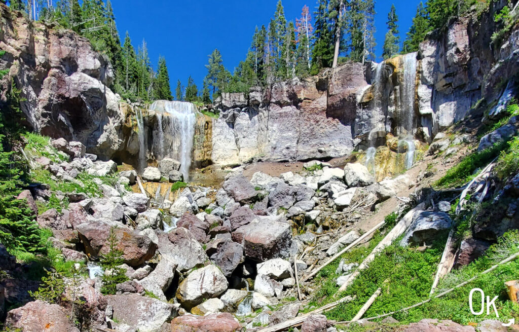
PAULINA CREEK FALLS
Paulina Lake has one outlet: Paulina Creek. Not far from the outlet is 80 foot Paulina Creek Falls. The falls are located just outside the Newberry Caldera. A short distance from the parking lot, off to the right, is the falls main viewpoint. Although this viewpoint is not bad, I prefer the short hike down to the river at the lower viewpoint.
BONUS SIGHT
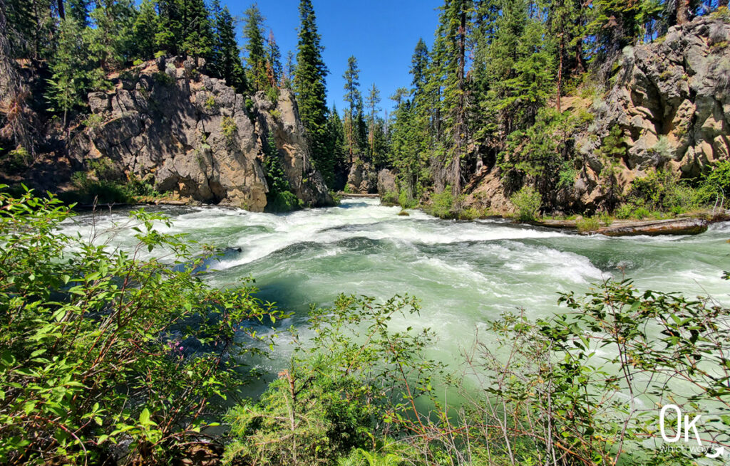
BENHAM FALLS
Four miles from the visitor center, along FS-9702, is the Benham Falls East Trailhead. From the Benham Bridge, the falls are a half mile walk on a well maintained trail that follows the Deschutes River. The falls, classified as Class 5 rapids, were created after the eruption of Lava Butte.
As far as waterfalls go, this one is not the most impressive. But, watching the pure force of water is breathtaking. Plus, the walk is lovely.
Pin this to help plan your trip to Newberry National Volcanic Monument ⬇