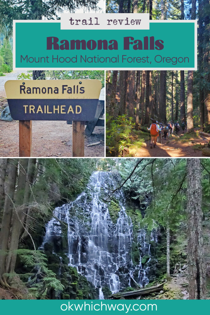
Hike to Ramona Falls on Mount Hood
Situated within Mount Hood National Forest, the Ramona Falls Trail offers a quintessential Pacific Northwest hiking experience, combining lush forest scenery with dramatic views. The majority of the seven mile journey is not difficult. However, there is one obstacle that needs serious attention, and that is safely crossing the Sandy River.
This post may contain affiliate links. When you make a purchase using one of these affiliate links, we get paid a small commission at no extra cost to you.
Ramona Falls Trail Stats
Trailhead: Ramona Falls
Trail Type: Lollipop Loop
Difficulty: ⟡ Challenging, primarily due to the river crossing; based on OK Which Way’s rating system
Distance: 7.2 miles
Elevation: 2441- 3493 feet

Planning Your Visit
Location: 1:15 hours east of Portland and 1:15 hours south of Hood River
Time Zone: Pacific Standard Time
Seasonal Closures: Gate to the trailhead opens around April 1
Parking: Decent sized lot at the Ramona Falls Trailhead, but it can fill up
Park Pass Needed: Federal Recreation Pass such as NPS America the Beautiful Pass or NW Forest Pass, or Oregon Sno-Park Permit from November 1 – April 30
Entrance Fee: $5/car check the Forest Service website for current fee pricing
Trail Map: Link to AllTrails map
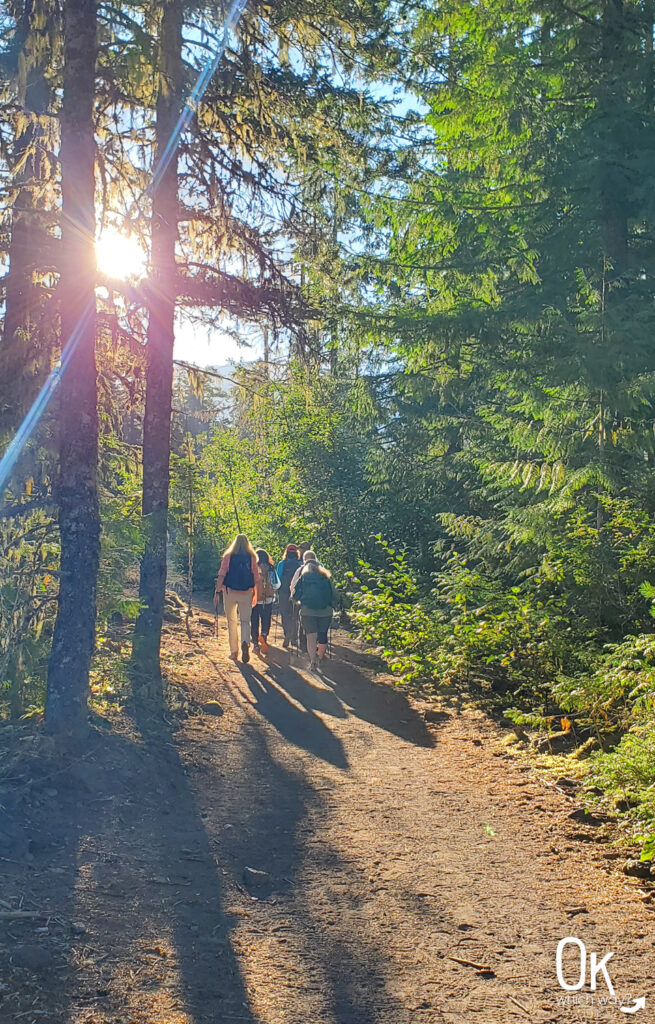
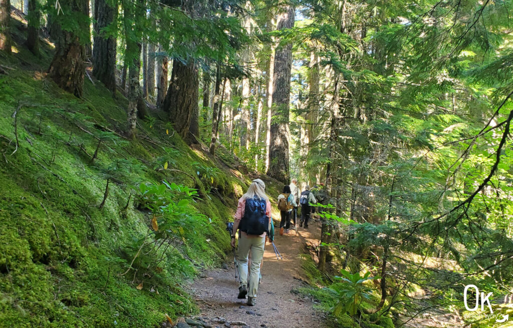
Getting to Ramona Falls Trailhead
The Ramona Falls trailhead is about seven miles off Highway 26, with numerous potholes in the final miles. A high clearance vehicle would be ideal.
Although the parking lot is good sized, there is no restroom at the trailhead.
The Ramona Falls trailhead is also the trailhead for both the Sandy River Trail and the Pacific Crest Trail. To reach Ramona Falls, you will begin by following the Sandy River Trail.
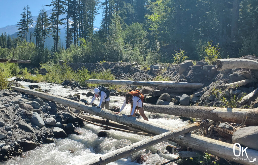
Sandy River Crossing
A little over one mile from the trailhead, the route involves a crossing of the Sandy River. The river is fed by glacial melt from Mount Hood. This is the most crucial part of the hike and requires caution. Do not attempt a crossing if the river is running fast. While there have been seasonal bridges in the past, they were dangerous and have since been removed. Hikers must choose to either carefully wade through the river or find a log spanning the water. In 2025, the most common way across the river was walking or scooting across a log near the main trail. Our group, however, chose to go slightly upstream and found two logs situated together—one to walk across, and the other to hold onto for support. It’s definitely worth checking AllTrails before going on this hike, as recent hikers may have mentioned the method they used to cross the river in their trail review.

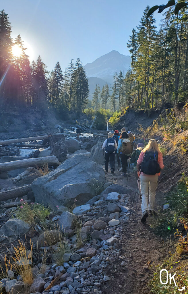
FUN FACT: The Sandy River is a designated Wild and Scenic River and the only Oregon river that originates on Mount Hood and is not dammed, flowing freely from its glacial source to the Columbia River

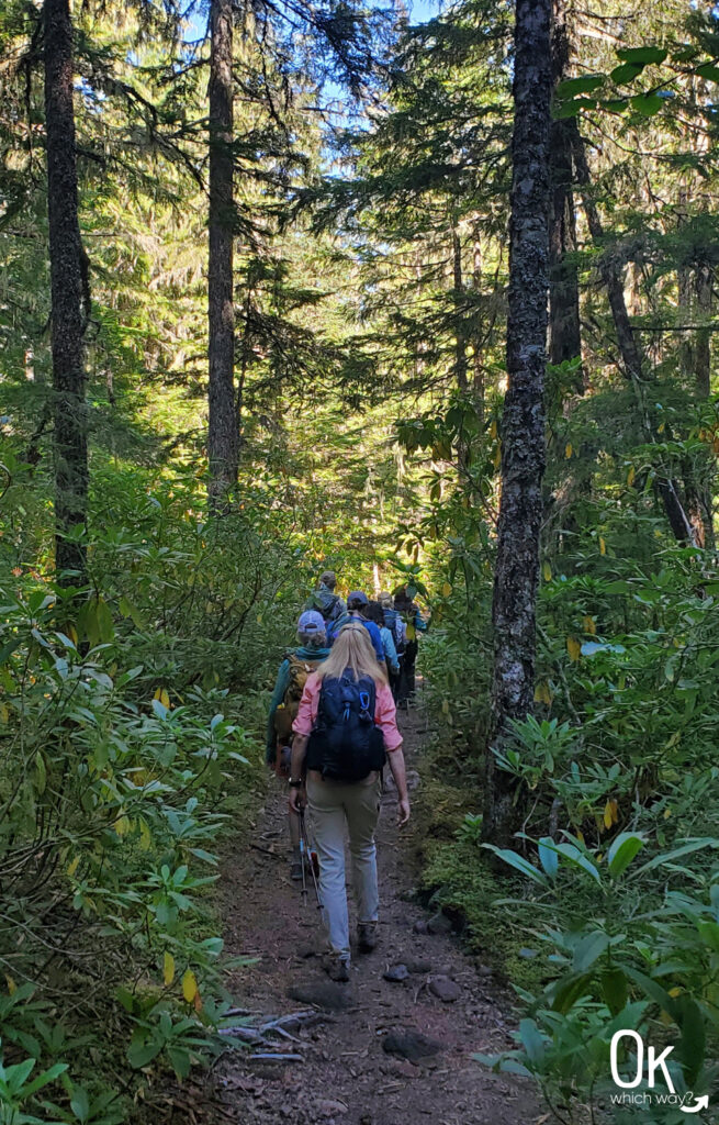
Continuing along the Trail to the Falls
Once safely across the Sandy River, the trail continues for about a quarter mile until reaching the Ramona Falls loop. This section of the trail intersects with the PCT, so there may be thru hikers on the trail, as well. From here, you can choose to walk the loop in either direction. We went to the right and hiked it counter clockwise. Then it is a steady, gentle climb to the waterfall.

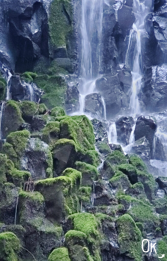
Ramona Falls
The stunning Ramona Falls is your perfect mid-point rest. The tree coverage and large rocks make it a great place to sit, relax, and refuel with a trail snack.

Ramona Falls Stats
Waterfall Height: 120 feet
Waterfall Type: Cascading Fan
Watershed: Sandy River
Source: Ramona Creek
Completing the Ramona Falls Loop
After taking some time to enjoy the falls, cross the footbridge over the creek to continue the loop. The return section is shadier, defined by a forest with lush moss, ferns, and a wonderful green area that follows Ramona Creek. Upon reaching the end of the loop, continue along the Sandy River Trail towards the trailhead. We walked along the river’s edge back to the log we walked across on the way to the falls, so we could go back the same way. Once across the river, it’s a little over a mile to the parking lot.


Final Thoughts
Overall, this hike is not difficult, provided you exercise caution at the river crossing. The constant changes in scenery make it an engaging and rewarding experience. I would like to time it right to go back and see the rhododendrons in bloom, but not when the river is raging with snow melt.
LEAVE NO TRACE
Optional Items to Bring
Our Stats
Date: August 2025
Distance: 7.77 miles
Start: Ramona Falls Trailhead
End: Ramona Falls Trailhead
Hiking Time: 4hrs 6min

Mount Hood Scenic Byway
Ramona Falls sits along the Mt Hood Scenic Byway. It is 105 miles beginning in the town of Troutdale, winding through Mt Hood National Forest, and ending near the Columbia River at Hood River.

Thinking About Hiking to Ramona Falls?
Pin This to Help Plan Your Trip ⬇
Other Places to Explore in Oregon
This trail review is based only on Jennifer’s experience. Hike at your own risk with the understanding that individual scenarios in a natural environment will be variable.