Paulina Falls Trail in Central Oregon
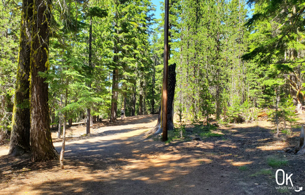
Paulina Falls is located within Newberry National Volcanic Monument. The day use area and trailhead are directly off Newberry Crater Road – the left turn seems to come out of nowhere, but it’s easy to find on your way to Paulina Lake, East Lake, or Paulina Peak. It can be a quick addition to your day, as the trails to view the falls are quite short.
This post may contain affiliate links. When you make a purchase using one of these affiliate links, we get paid a small commission at no extra cost to you.
Paulina Falls Trail Stats
Trailhead: Paulina Falls Trailhead
Trail Type: Out and Back
Difficulty: ⚪ Easy based on OK Which Way’s rating system
Distance: .75 miles
Elevation: 6200 feet
Planning Your Visit
Location: Paulina Falls Trail within Newberry National Volcanic Monument off Highway 21. About 45 minute drive south, then east of Bend
Time Zone: Pacific Standard Time
Seasonal Closures: Check current conditions, the area may be closed due to weather
Parking: Paulina Falls Trailhead
Park Pass Needed: Both the NW Forest Pass and NPS America the Beautiful Pass are accepted
Entrance Fee: $5/car. Fee station is not available on site. You can get a pass at the Lava Lands Visitor Center or other Forest Service offices. click here to see current fee pricing
Trail Map: AllTrails map
Pets: Leashed dogs permitted
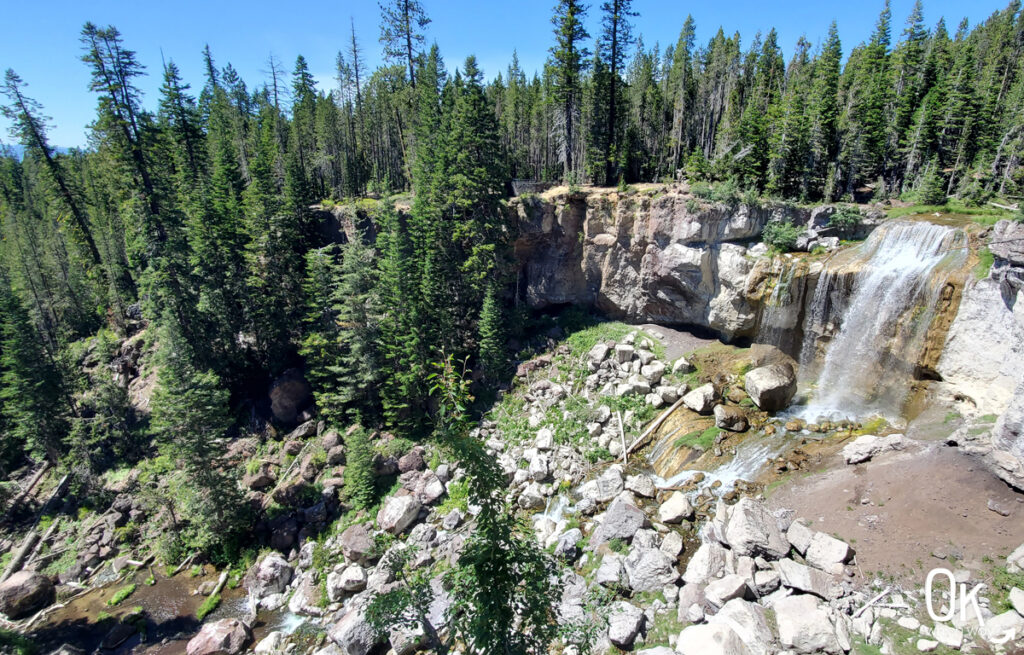
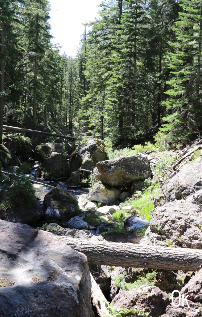
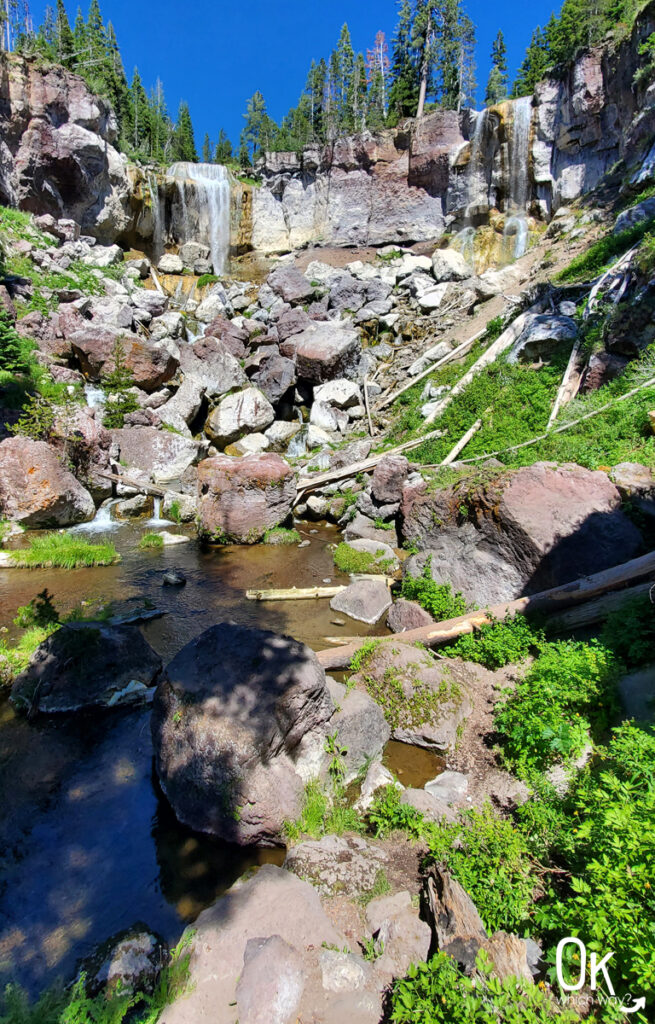
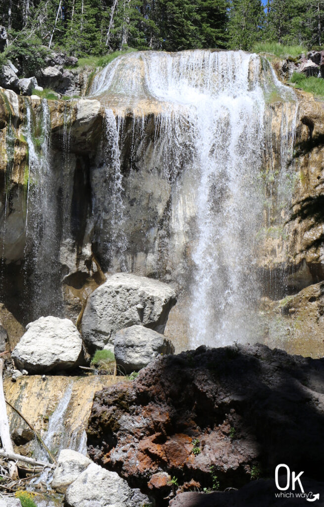
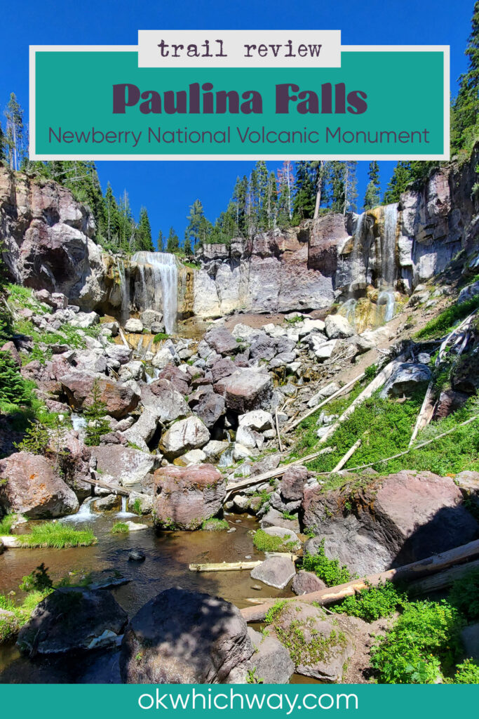
Paulina Creek Falls
Paulina Creek is named after Chief Paulina and is Paulina Lake’s one and only outlet. The creek doesn’t go far before reaching the cliff that provides the 80 foot drop for the falls. Paulina Falls are somewhat unique in that there are two cascading flows of water tumbling to the creek below.
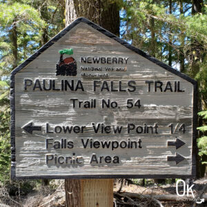
There are two viewpoints, one above the falls and one below. The trailhead is just a short distance from the parking lot.
Upper Viewpoint
From the trailhead, walking towards the right will place you on a short, paved trail to the upper viewpoint.
If you’re looking for a longer adventure, the trail does continue to Paulina Lake and from there multiple hiking trail options.
Paulina Falls Stats
Waterfall Height: 80 feet
Waterfall Type: Segmented Plunges
Watershed: Deschutes River
Source: Paulina Creek
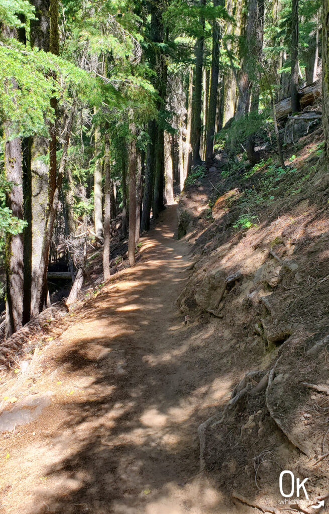
Lower Viewpoint
Heading to the left at the trailhead will take you to a dirt path down to Paulina Creek, with views of the falls from below. The narrow path is lovely as it winds through the trees. It is only a quarter mile to the creek, but it is a little steep with a couple switchbacks.
LEAVE NO TRACE
Optional Items to Bring
Thinking About Heading to Paulina Falls?
Pin This to Help Plan Your Trip ⬇
Explore More in Central Oregon
This trail review is based only on Jennifer’s experience. Hike at your own risk with the understanding that individual scenarios in a natural environment will be variable.