Hedge Creek Falls Trail in Dunsmuir, California
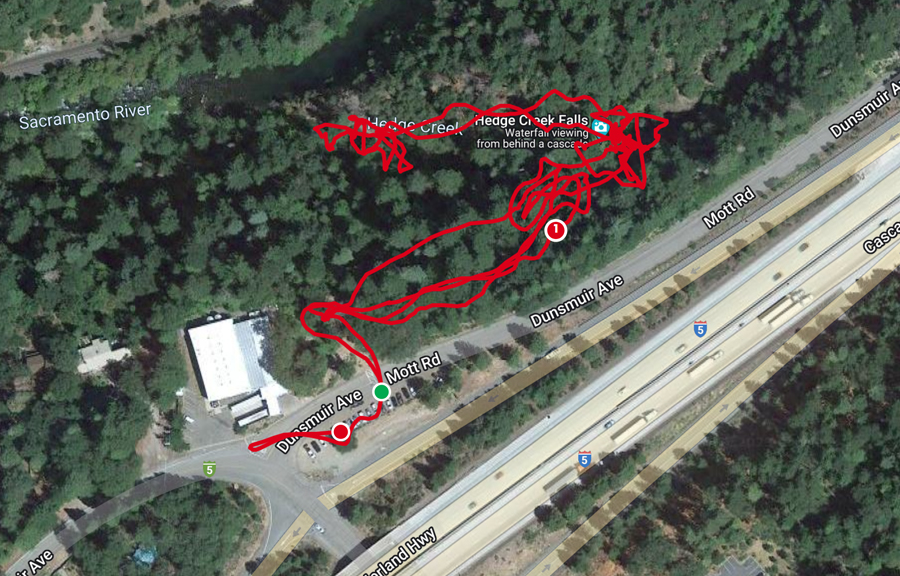
Located about an hour north of Redding is Hedge Creek Falls. It is a great stop along I-5 if you’re traveling a long distance. The trailhead is just off the Interstate and near a parking area that holds about 20 cars. I’m always on the lookout for a quick hike to do when we have long days in the car. This spot was perfect.
This post may contain affiliate links. When you make a purchase using one of these affiliate links, we get paid a small commission at no extra cost to you.
Hedge Creek Falls Trail Stats
Trail Type: Out and Back
Difficulty: ⚪ Easy based on OK Which Way’s rating system
Distance: 1 mile
Elevation: 2600 feet
Planning Your Visit
Location: near Dunsmuir, California, an hour north of Redding. An easy detour off I-5
Address: Parking lot at 506 Dunsmuir Avenue, Dunsmuir, California
Time Zone: Pacific Standard Time
Park Pass Needed: none
Entrance Fee: none
Trail Map: Link to AllTrails map
Pets: Dogs on leashes allowed
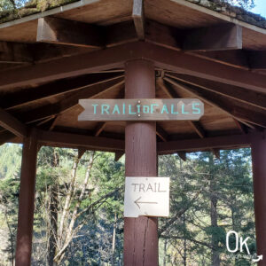
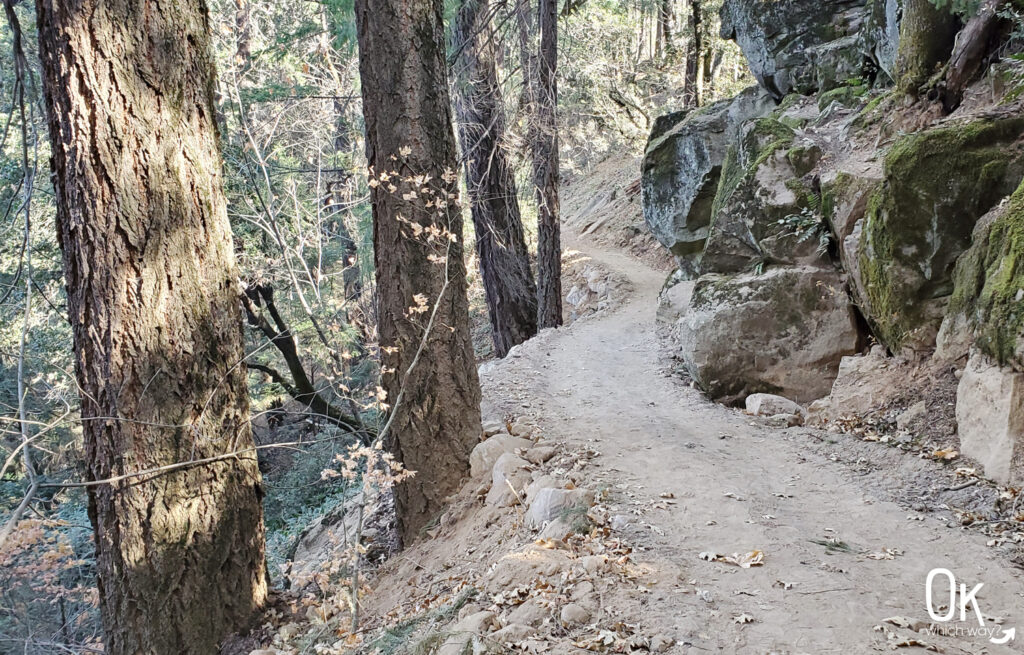
Walking to the Falls
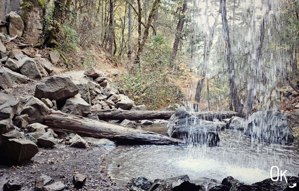
It’s about a quarter mile walk down a dirt trail to the falls.
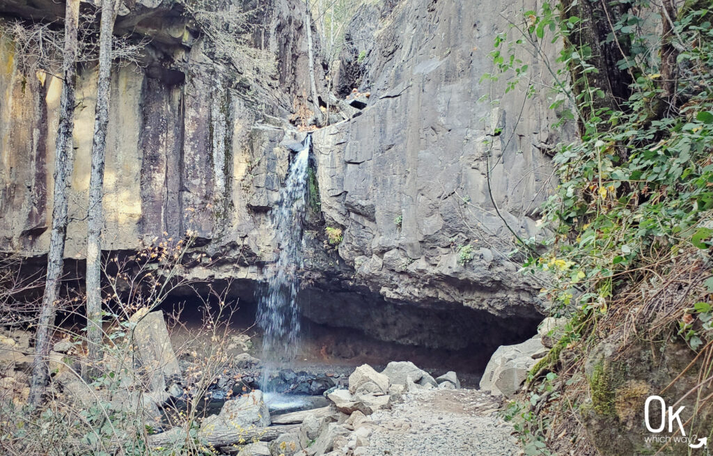
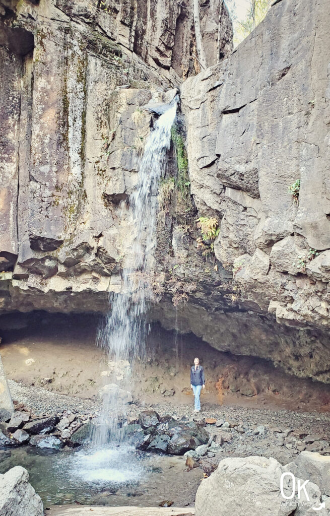
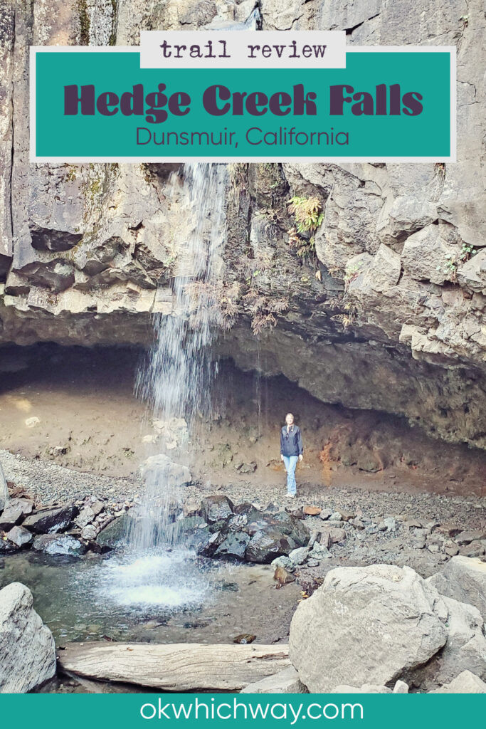
Hedge Creek Falls
Admittedly, the water flow was less than impressive during our visit. But, the hike through the canyon was lovely. I’m a sucker for landscapes that have columnar basalt.
Hedge Creek Falls Stats
Waterfall Height: 30 feet
Waterfall Type: Plunge
Watershed: Upper Sacramento River
Source: Hedge Creek
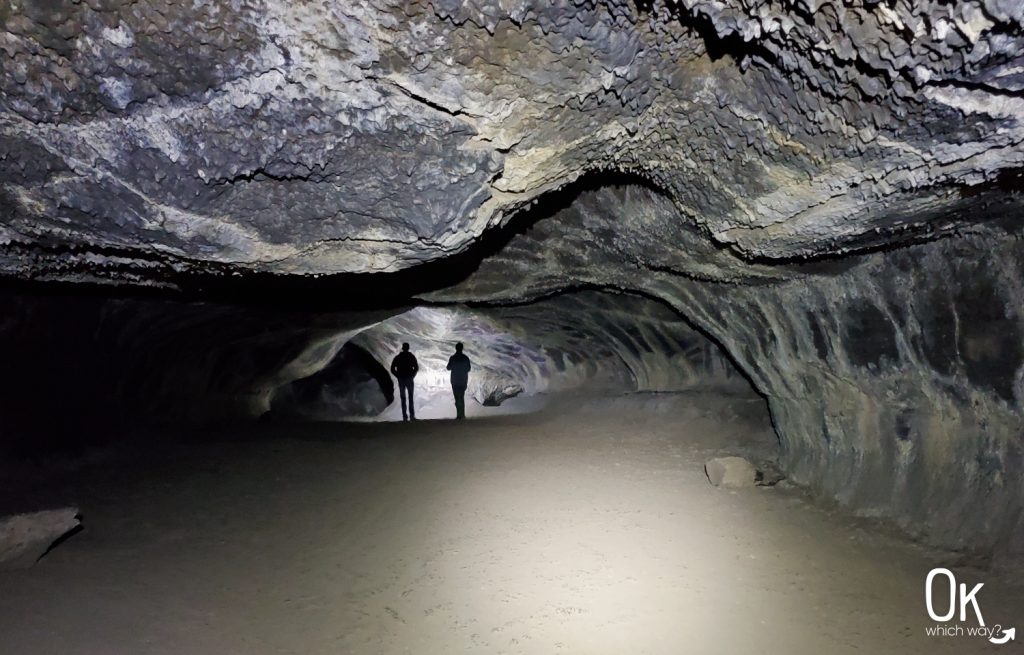
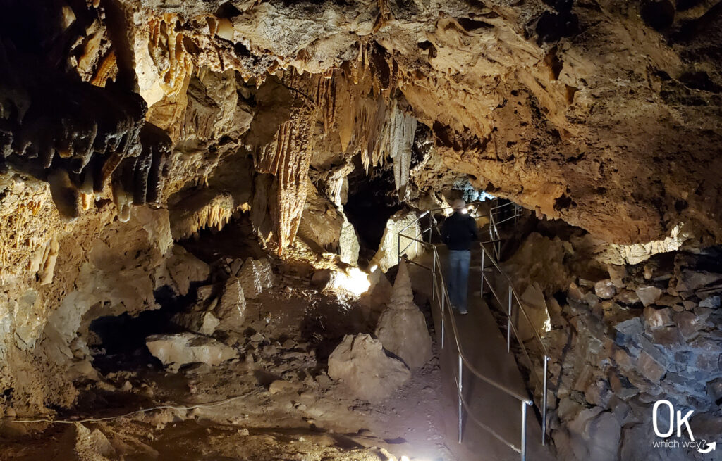
The trail takes you behind the falls – which is fun no matter how old I get.
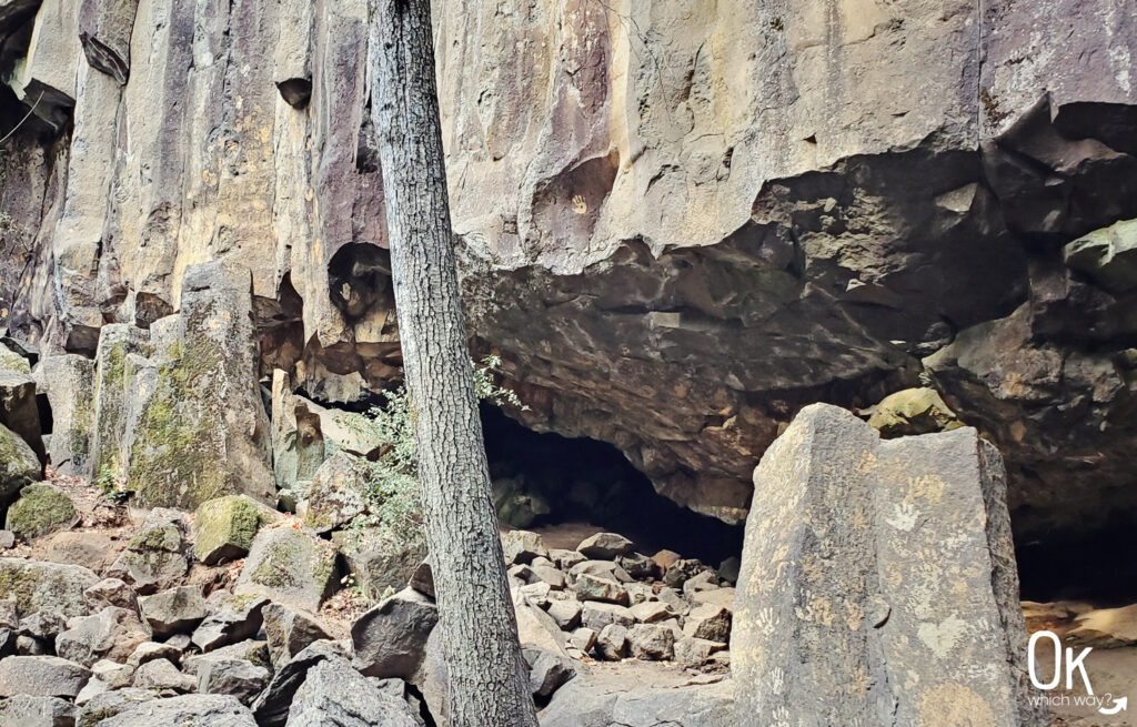
Columnar Basalt
Hedge Creek Falls was formed, in part, by an ancient lava flow from Mount Shasta. The slow cooling and contraction of lava caused cracks creating the hexagonal columns. If you have perused my website a bit, you might know that I find columnar basalt fascinating. A stunning example of columnar basalt is the Giant Causeway in Ireland, which is on my bucket list.
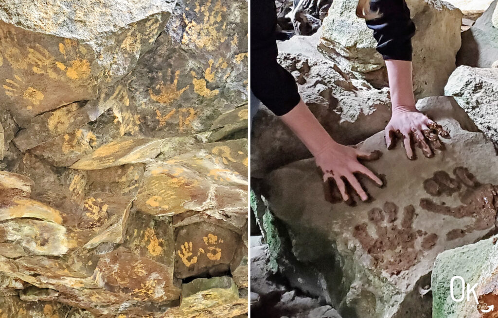
Handprints
I don’t know if there is a story associated with the handprints all over the rock at the cave. But, we dipped our hands in the mud and added to the collection.
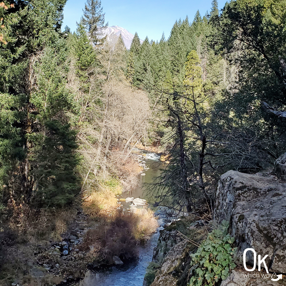
Mount Shasta Viewpoint
Continue past the waterfall to a catch a glimpse of Mt Shasta.
Final Thoughts
The hike was just what we needed during a long day in the car. We were able to be outside enjoying a nice, autumn day for almost an hour. I would definitely hike this trail again.
LEAVE NO TRACE
Optional Items to Bring
Our Stats
Date: November 2019
Distance: 1 mile
Hiking Time: 1 hour

Hedge Creek Falls sits along the edge of the Volcanic Legacy Scenic Byway
Thinking About Stopping at Hedge Creek Falls?
Pin This to Help Plan Your Trip ⬇
More Places to Explore in Northern California
This trail review is based only on Jennifer’s experience. Hike at your own risk with the understanding that individual scenarios in a natural environment will be variable.