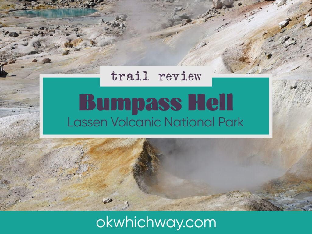
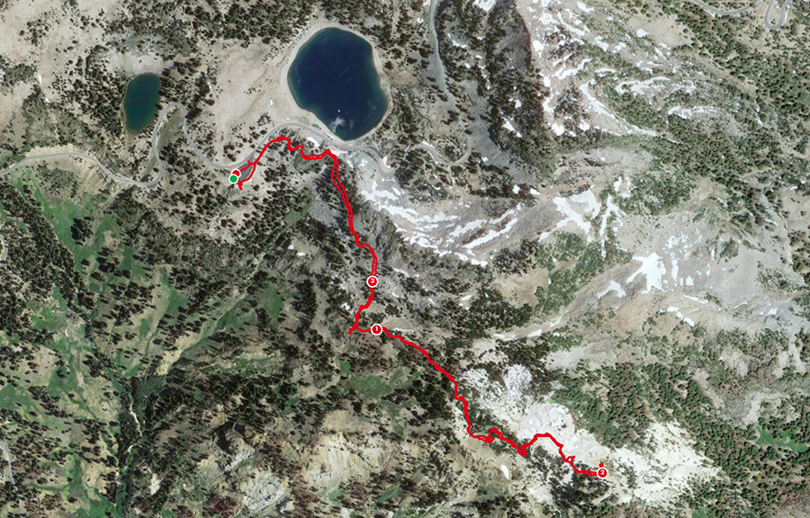
Bumpass Hell Trail in Lassen Volcanic National Park
Located within Lassen Volcanic National Park, the three mile hike along the Bumpass Hell trail rewards you with views of spectacular hydrothermal features. The steam vents, hot springs, mudpots, and bubbling water are THE reason to explore this trail. It is one of the most popular in the park with views of rock, alpine fauna, and mountains in the distance.
This post may contain affiliate links. When you make a purchase using one of these affiliate links, we get paid a small commission at no extra cost to you.
Bumpass Hell Trail Stats
Trailhead: Bumpass Hell Trailhead
Trail Type: Out and Back
Difficulty: 🟢 Moderate based on OK Which Way’s rating system
Distance: 3.3 miles
Elevation: 8142 – 8386 feet

Planning Your Visit
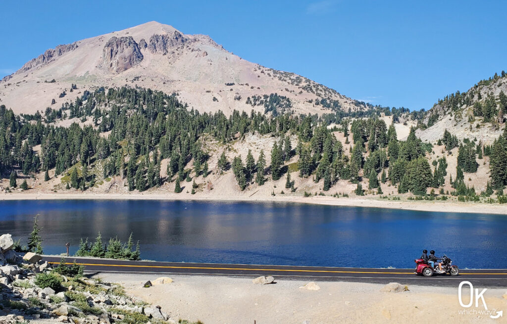
Location: Off Lassen Peak Highway near Lake Helen. About 1.5 hours from Redding, California
Time Zone: Pacific Standard Time
Seasonal Closures: Bumpass Hell Trail closes seasonally and is generally open late July through October
Parking: Bumpass Hell Trailhead
Park Pass Needed: National Park Entrance Pass or NPS America the Beautiful Pass
Entrance Fee: $30/car click here to see current fee pricing
Trail Map: Link to AllTrails map
Pets: No pets allowed on the Bumpass Hell trail
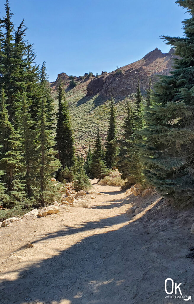
The First Mile
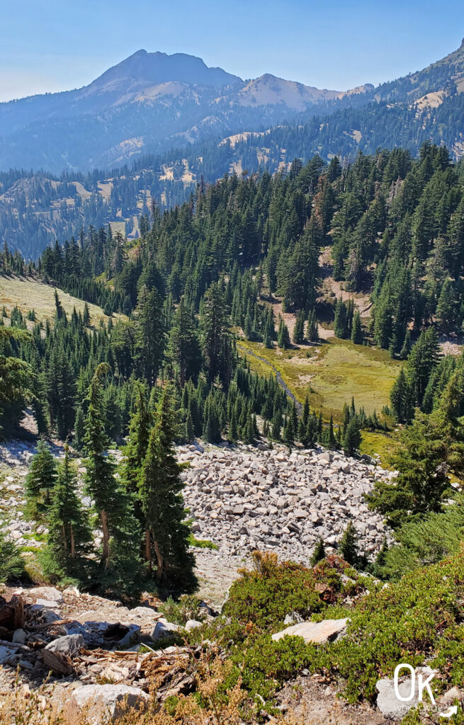
The trailhead is located at the parking lot, which sits at an elevation of 8200′. It is a lightly graveled path that is well maintained. There is a bit of an incline throughout the first mile, but nothing extremely steep. Although there are trees along the trail, there is a lot of sun exposure.
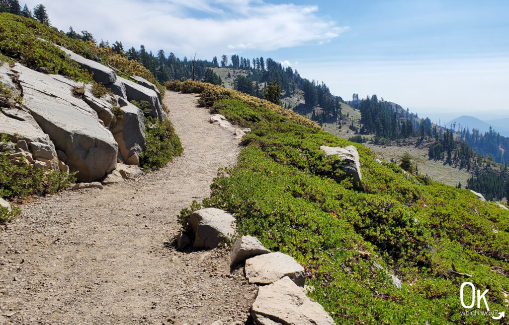
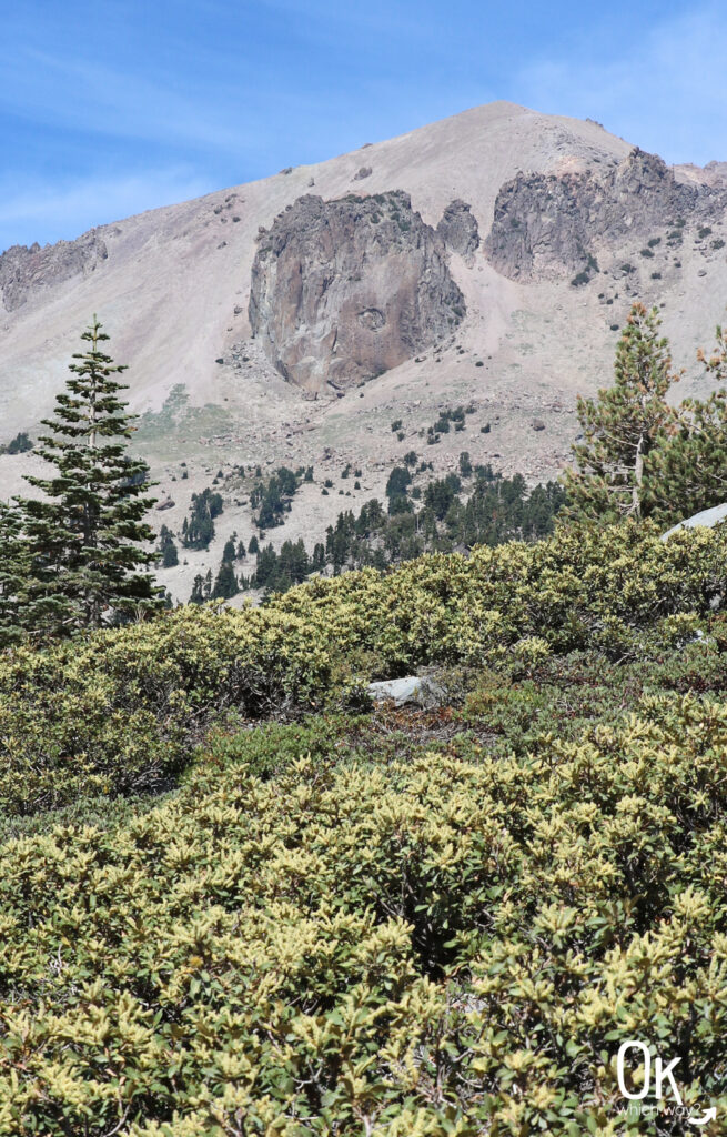
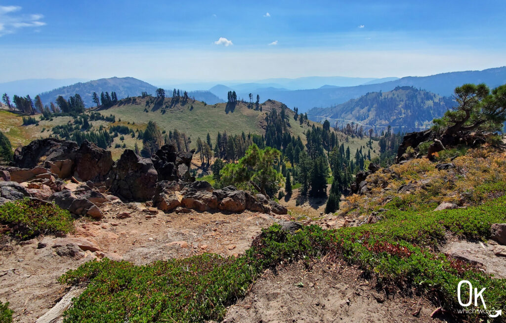
The view from Brokeoff Volcano Vista was amazing – even with the wildfire smoke. About a quarter mile past the viewpoint you can start to smell the sulfur coming from the hydrothermal basin.
Basin Overlook
After walking about a mile from the trailhead, you will reach an overlook with a great view into the hydrothermal basin. It’s an ideal spot to turn around if you don’t have the time to go further.
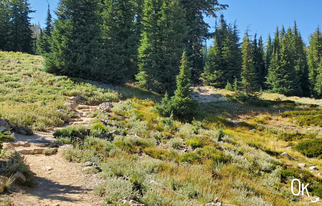
The Final Stretch into the Basin
The half mile down into the basin is sketchier than the first mile. It is maintained, but is steeper, slipperier, and quite a few roots are in the path. Hiking poles aren’t necessary, but would be nice to have in this section.
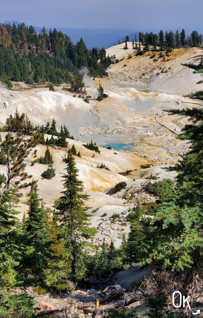
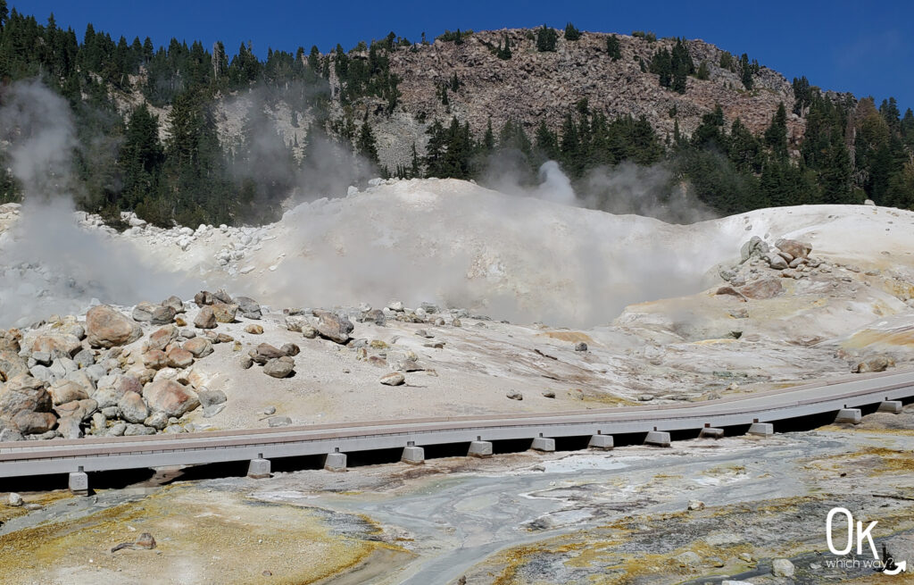
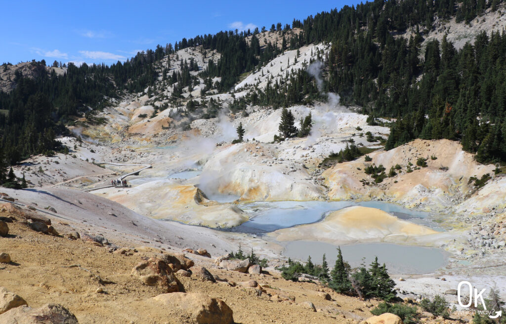
Bumpass Hell Basin
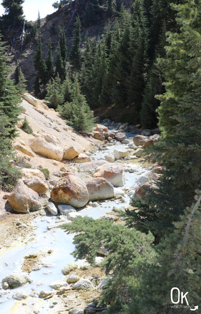
Once you reach the boardwalk you are in the hydrothermal zone.
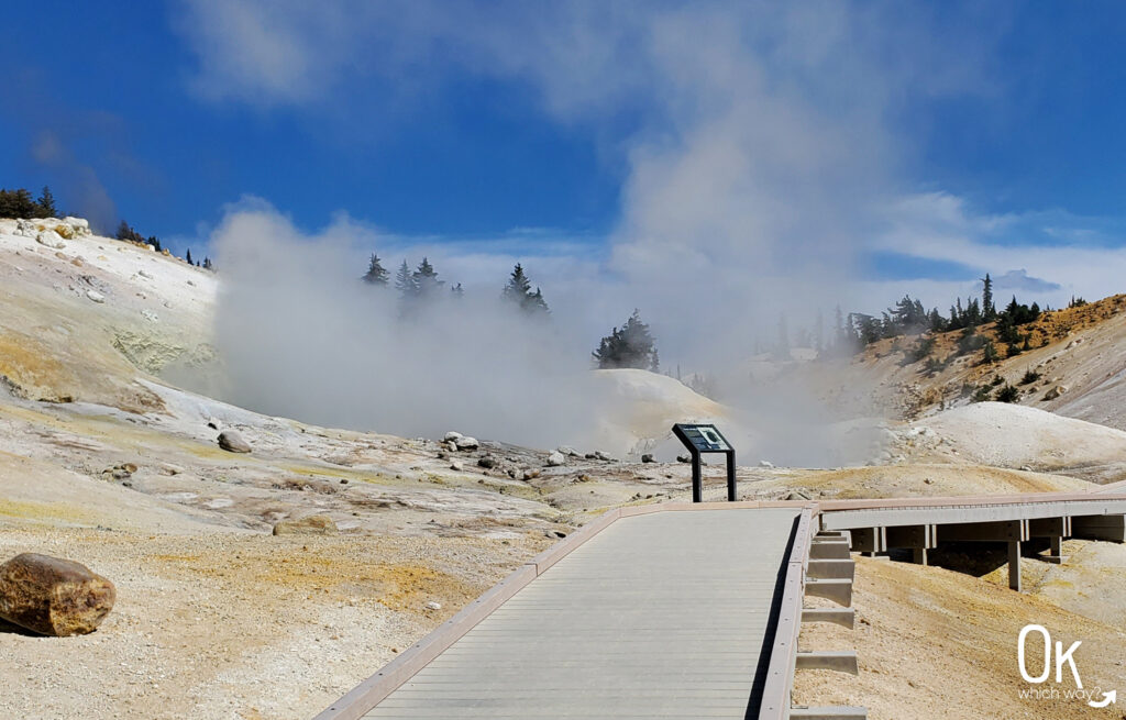
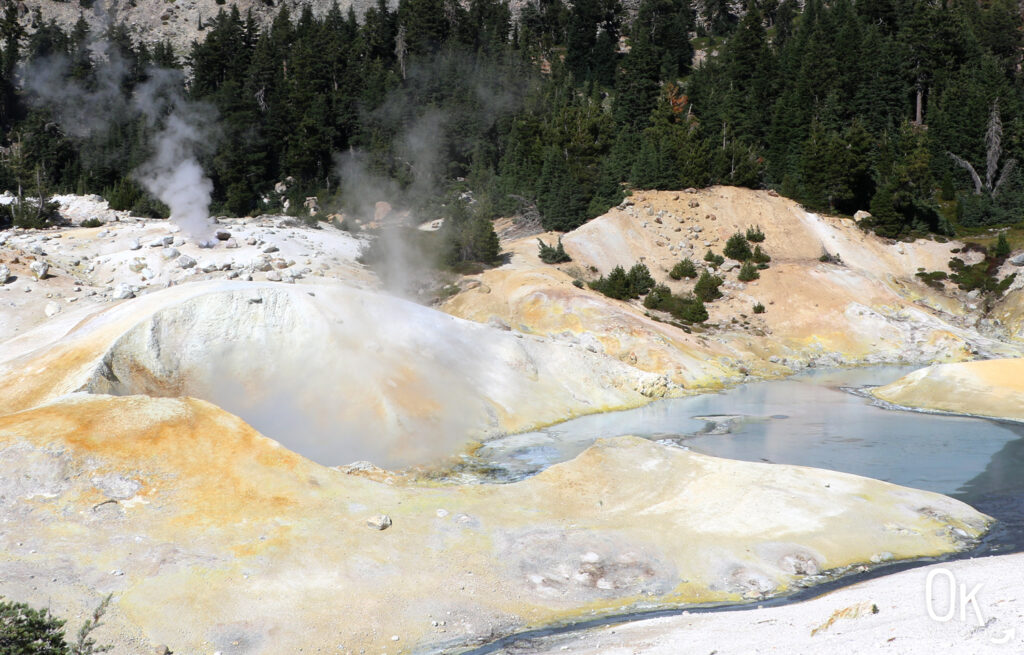
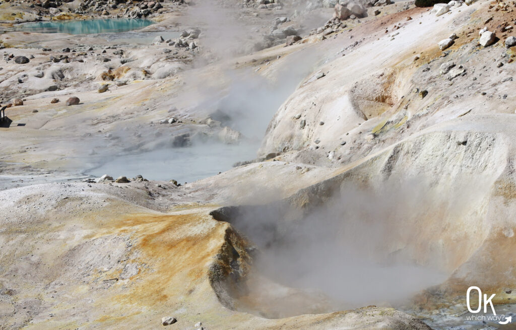
Things to Look for in the Basin
- Fumaroles, or steam vents – where steam and gas rise to the Earth’s surface and escape through vents. They often have a pungent smell.
- Hot Springs and Murky Pools of Water – heated by steam from deep within the Earth. The murky appearance is caused by sulfuric acid created, in part, by microscopic organisms. The acid breaks down rock lining the pool into small particles creating a murky appearance.
- Mudpots – hot springs that contain a lot of clay and can change with the seasons.
- Bubbling Water – caused by the release of carbon dioxide under water
Continuing past the boardwalk and up a little hill leads you to the East Overlook. It’s also possible to walk a couple more miles and end up at Cold Boiling Lake, Crumbaugh Lake, or the Kings Creek picnic area.
Heading Back
Since this is an out and back trail, to head back to your car you turn around and retrace your steps. The initial hike out of the basin is a bit strenuous due to the incline. But once you reach the basin overlook, the remaining trek back to the parking lot is relatively easy.
LEAVE NO TRACE
Optional Items to Bring
Our Stats
Date: September 2022
Distance: 3.3 miles
Start: Bumpass Hell Trailhead
End: Bumpass Hell Trailhead
Hiking Time: 2 hours
Thinking About Hiking to Bumpass Hell?
Pin This to Help Plan Your Trip ⬇
More Outdoor Places to Explore in Northern California
This trail review is based only on Jennifer’s experience. Hike at your own risk with the understanding that individual scenarios in a natural environment will be variable.