Sahalie Falls, Koosah Falls and Blue Pool via the McKenzie River Trail
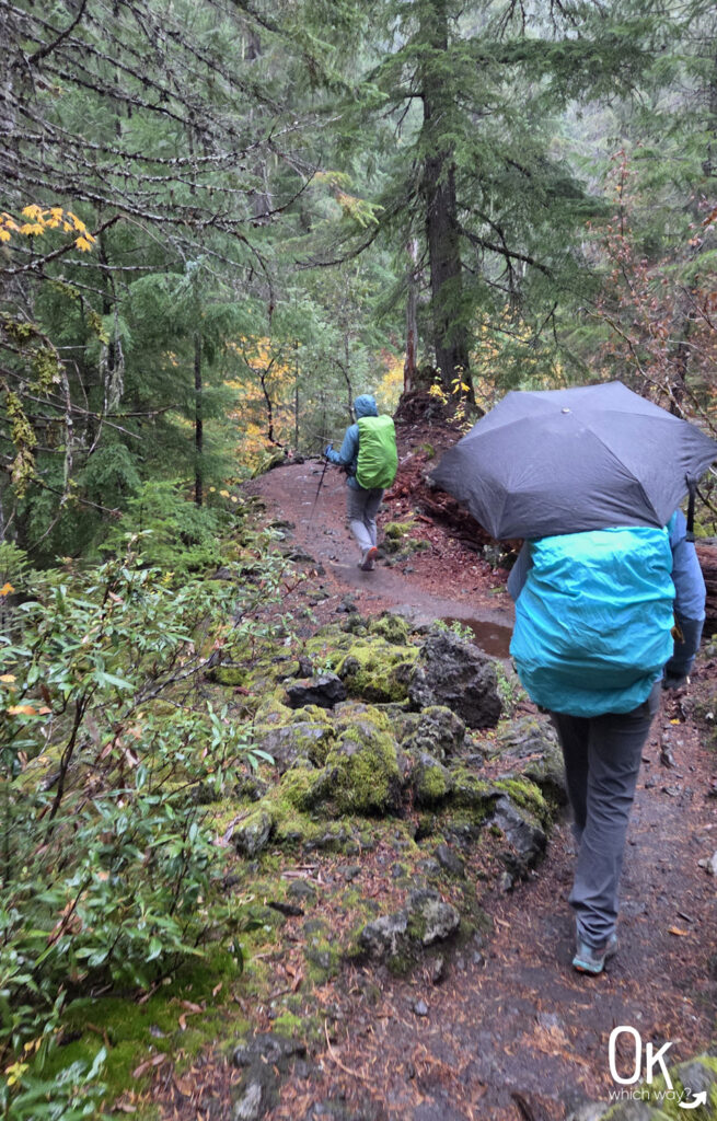
I had been to Sahalie Falls and I’ve hiked to Blue Pool. But this was the first time I hiked from Sahalie Falls to Blue Pool and back. This 10 mile trek along the McKenzie River Trail takes you through an old-growth forest over lava rocks, as well as offering views of two stunning waterfalls and one of the clearest, bluest pools you’ll ever see. I embarked on this adventure with a wonderful crew of women on a very, very wet October morning.
This post may contain affiliate links. When you make a purchase using one of these affiliate links, we get paid a small commission at no extra cost to you.
Sahalie Falls to Blue Pool Trail Stats
Trailhead: Sahalie Falls Viewpoint
Trail Type: Out and Back
Difficulty: 🟦 Intermediate based on OK Which Way’s rating system
Distance: 10 miles
Elevation: 3300 feet

Planning Your Visit or How To Get There
Location: 1.5 hours NE of Eugene and 40 minutes from Sisters
Time Zone: Pacific Standard Time
Seasonal Closures: Although the trail is not closed in winter, vehicle access is limited
Parking: Sahalie Falls Viewpoint parking lot
Park Pass Needed: none
Entrance Fee: none
Park Maps / Trail Map: Link to AllTrails maps
Pets: Dogs on leashes permitted
Sahalie Falls Viewpoint
We used the Sahalie Falls viewpoint as our start and end points. The parking lot at Sahalie Falls isn’t large, but it does have a restroom.

Sahalie Falls
We began the trip with a quick peek of Sahalie Falls from the main viewpoint. It really is a stunning sight, even when the sky is gray.

Sahalie Falls Stats
Waterfall Height: 73 feet
Waterfall Type: Segmented Plunges
Source: McKenzie River
The Journey to Blue Pool
After admiring the falls, we jumped onto the Waterfalls Loop Trail. We followed the path to the right, which took us behind Sahalie Falls. As the trail swung around and started heading south, it connected us directly with the McKenzie River Trail.

After about a mile and a half we passed Carmen Reservoir. Then, for the next couple miles the path gradually descends through the Willamette National Forest until reaching Tamolitch Blue Pool.

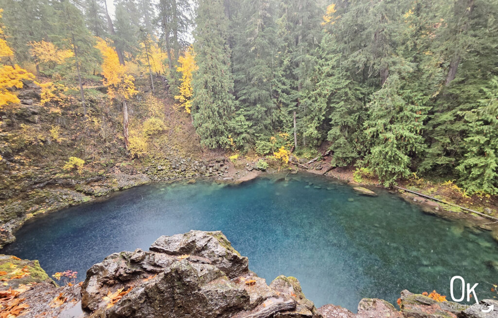
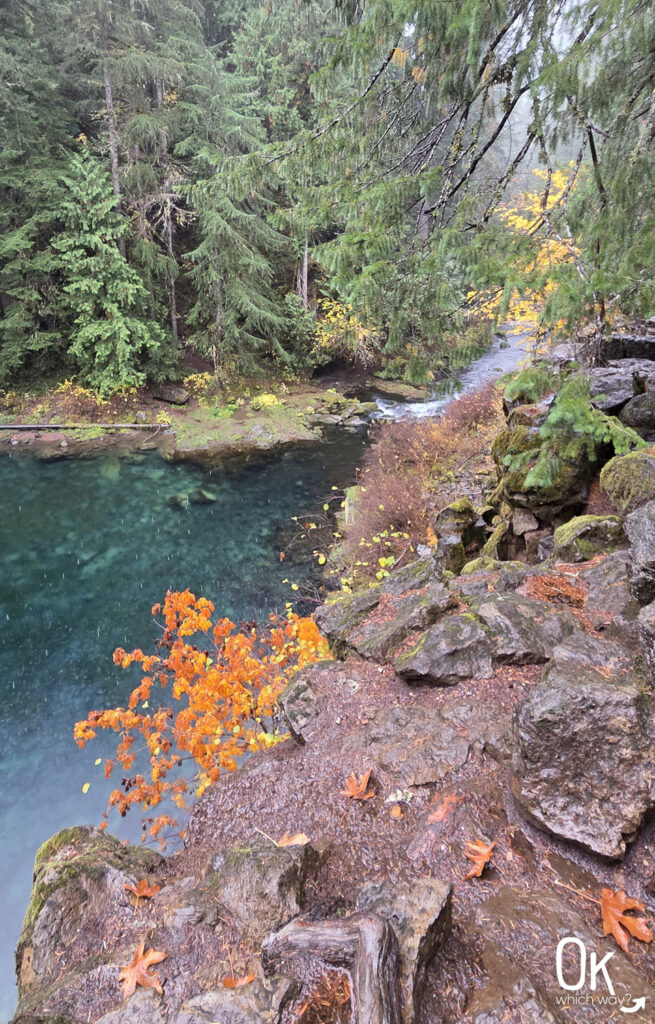
Blue Pool
Between Carmen Reservoir and Tamolitch Falls the McKenzie River is buried under a 1600 year old lava flow. Instead of flowing on the surface, the water travels underground, eventually resurfacing from hidden springs to feed the strikingly clear Tamolitch Pool (which everyone just calls Blue Pool). Tamolitch Falls, which is considered the third waterfall in this section, is almost always dry. Even on the incredibly rainy day we were there, there was not a waterfall.
The Little Things Seen on the Trail
Atheniella aurantiidisca – Tangerine bonnet
Tangerine bonnets are a small, inedible mushroom that are quite common in the wet Pacific Northwest forests.

The Return and Koosah Falls
The blue pool and autumn leaves were a beautiful color combination, but because it was pouring out we did not stick around long to admire it. It was a quick stop and then a fast turn around to head back up the river.

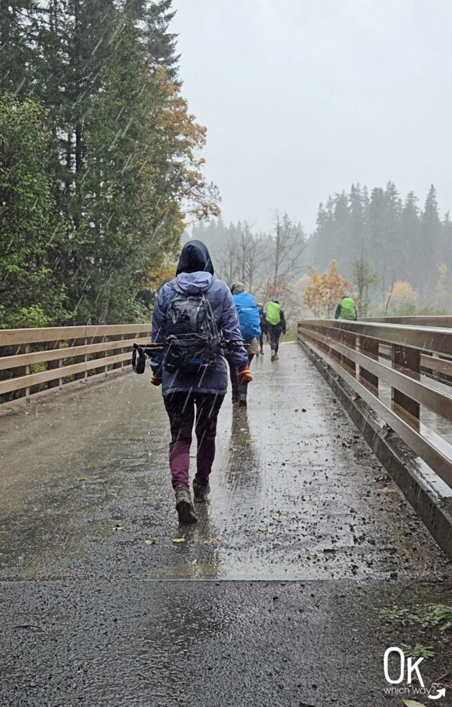
For the trip back, we opted for a slight change of scenery. Instead of following the trail all the way back to Sahalie Falls the way we came, we exited at Carmen Reservoir, walked along the road, crossed the bridge, and linked up with the eastern side of the Waterfalls Loop Trail. This led us past Koosah Falls. From here, it was just a short distance to complete our circuit and get us back to the parking lot.

Koosah Falls

Koosah Falls Stats
Waterfall Height: 74 feet
Waterfall Type: Curtain
Source: McKenzie River
Final Thoughts
Even with the soaking rain, hiking the trail from Sahalie Falls to Blue Pool was an incredible experience that I highly recommend. This section of the McKenzie River Trail offers classic Central Oregon beauty, combining the roaring power of the falls with the serenity of Blue Pool.
LEAVE NO TRACE
Optional Items to Bring
Our Stats
Date: October 2025
Distance: 10.5 miles
Start: Sahalie Falls Viewpoint
End: Sahalie Falls Viewpoint
Hiking Time: 5 hours
West Cascades Scenic Byway
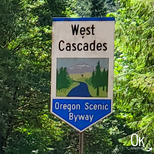
The 220 mile West Cascades Scenic Byway begins in Westfir, near Oakridge, then travels along the Cascade Mountains north to Estacada.
*note: parts of the byway are closed during winter
McKenzie Pass – Santiam Pass Scenic Byway

The McKenzie Pass – Santiam Pass Scenic Byway is an 82 mile loop beginning in Sisters. The route then travels along the McKenzie Pass, Hwy 126, and Santiam Pass before returning to Sisters.
*note: parts of the byway are closed during winter
Thinking About Exploring the McKenzie River Trail?
Pin This to Help Plan Your Trip ⬇

More Places to Explore in Central Oregon
This trail review is based only on Jennifer’s experience. Hike at your own risk with the understanding that individual scenarios in a natural environment will be variable.