
Headland Trail at Port Orford Heads State Park, Oregon
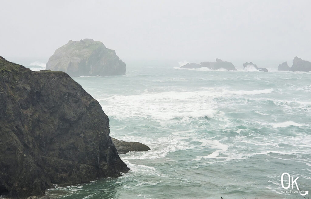
During our adventure along the southern Oregon coast, we hiked the easy Headland Trail at Port Orford Heads State Park. Walking among the dramatic cliffs and expansive Pacific Ocean made this walk a perfect way to start our day.
This post may contain affiliate links. When you make a purchase using one of these affiliate links, we get paid a small commission at no extra cost to you.
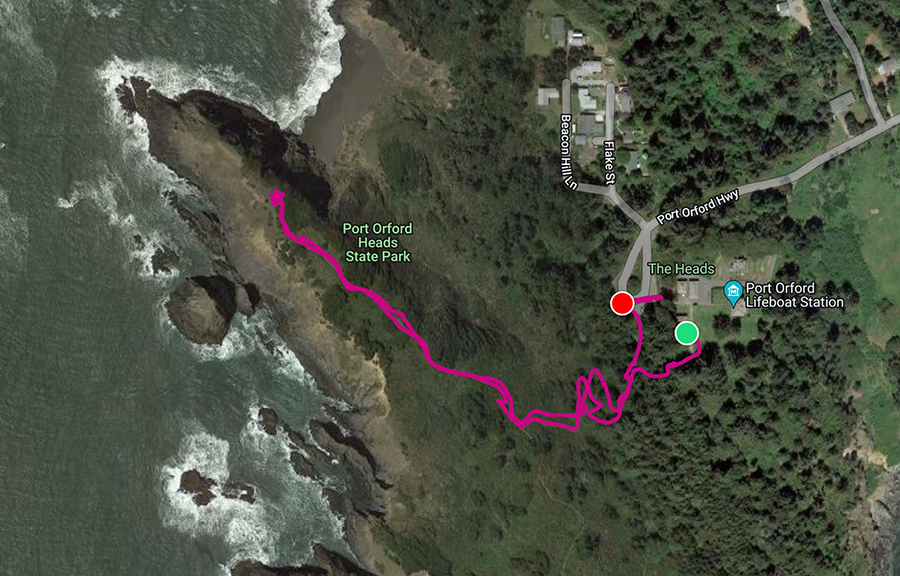
Headland Trail Stats
Trailhead: Port Orford Lifeboat Station Trailhead
Trail Type: Loop
Difficulty: ⚪ Easy based on OK Which Way’s rating system
Distance: 1.2 miles. We skipped the furthest spur trail to the east and only walked .81 miles
Elevation: 200 feet
Planning Your Visit
Location: about half an hour south of Bandon, OR
Time Zone: Pacific Standard Time
Parking: The West Trailhead is located near x
Park Pass Needed: none
Entrance Fee: none
Trail Map: Link to AllTrails map
Pets: Dogs allowed on leash
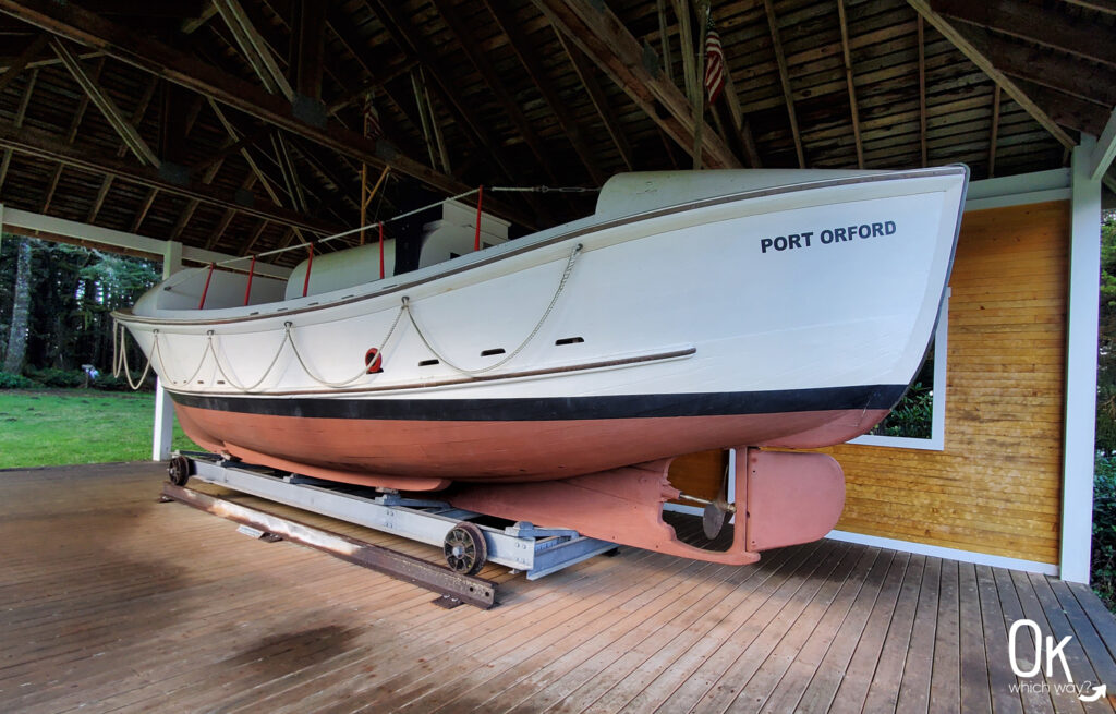
Port Orford Lifeboat Station
The Coast Guard watched for problems at sea from the Port Orford Lifeboat Station from 1934 – 1970. The crew quarters is now a museum (which was closed when we visited) and the entire station is listed on the National Register of Historic Places. When rescue was needed, the surfmen went to help using boats like this 36′ self righting motor lifeboat.
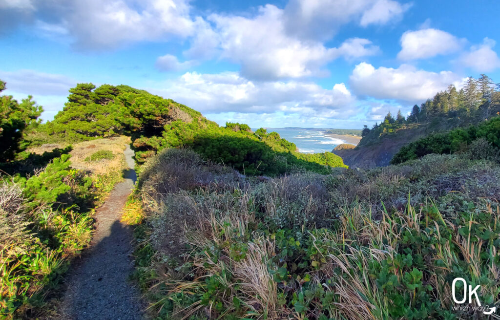
Headland Trail
We parked in the main parking area, explored the grounds a bit, then found our trailhead sign just south of the lifeboat pavilion.
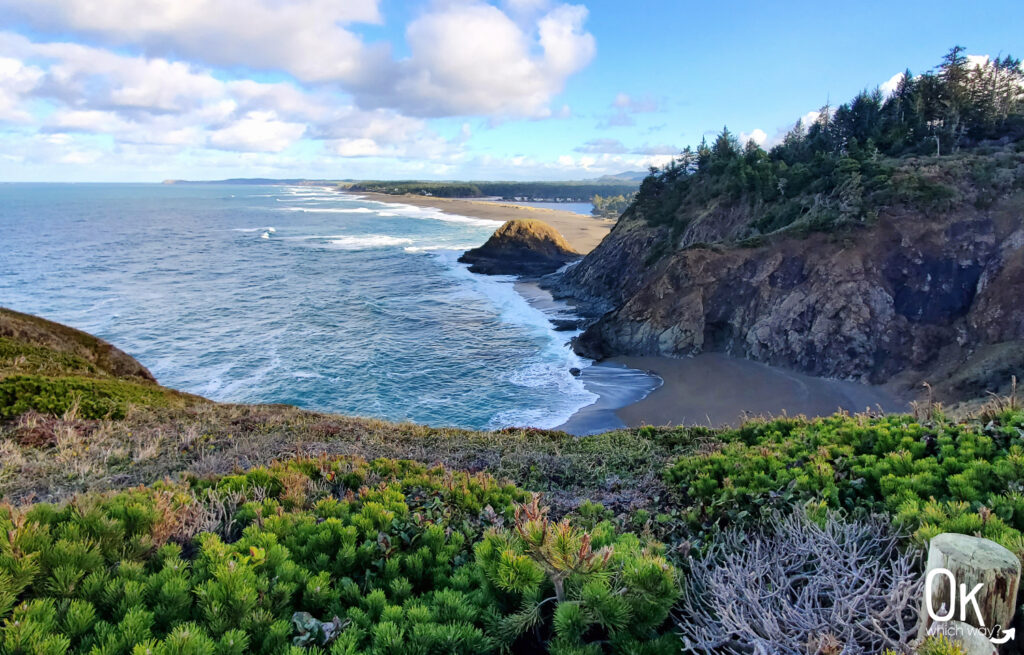
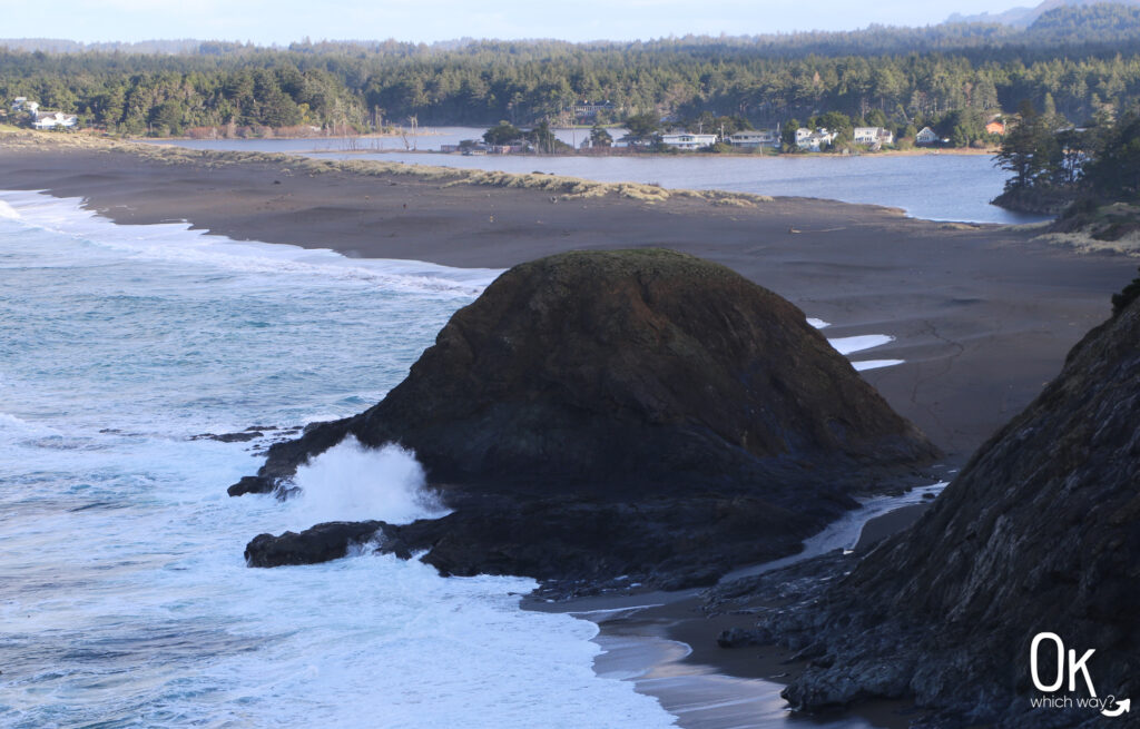
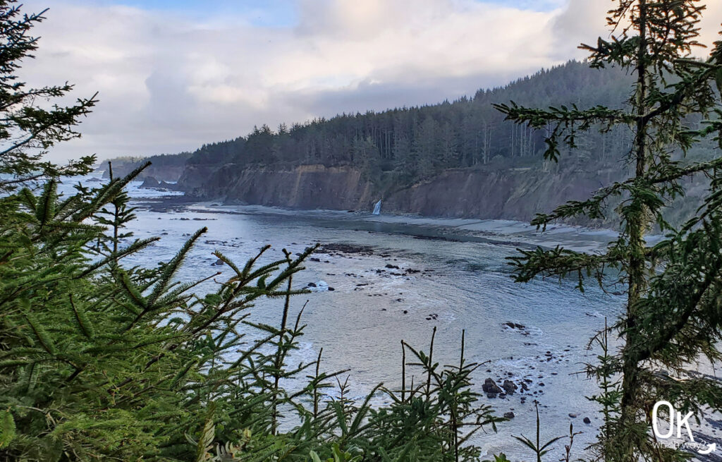
The narrow trail began under a cover of trees and gradually opened up to a spectacular view of the Pacific Ocean.

The Little Things
Native to Oregon, a Coast Silk Tassel in bloom

Heading Back
After taking in the fantastic view, we simply turned around and went back the same we came and continued our exploration of the southern Oregon coast. Had we taken the trail and looped around the east side we would have had views of Nellie’s cove.
LEAVE NO TRACE
Optional Items to Bring
Our Stats
Date: February 2021
Distance: .81 miles.
Start: Port Orford Lifeboat Station
End: Port Orford Lifeboat Station
Hiking Time: 34 min
More to Explore Along the Southern Oregon Coast
This trail review is based only on Jennifer’s experience. Hike at your own risk with the understanding that individual scenarios in a natural environment will be variable.