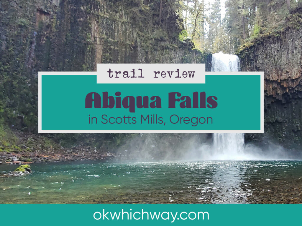
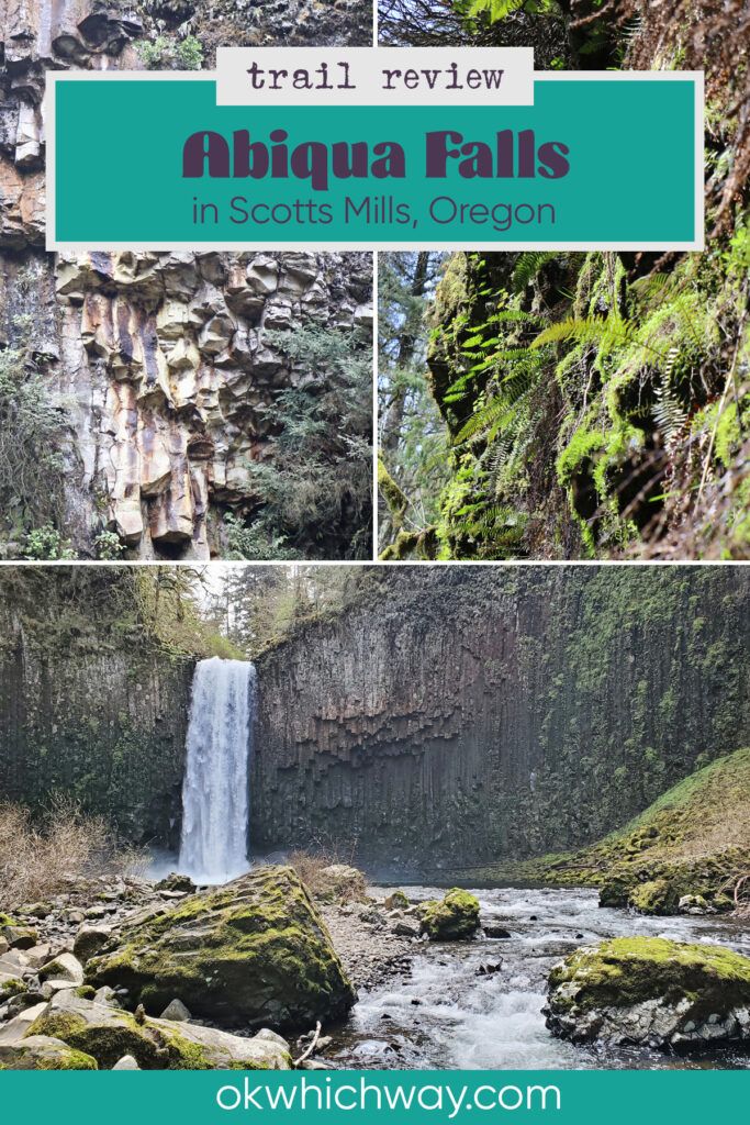
Hiking to Abiqua Falls near Silverton, Oregon
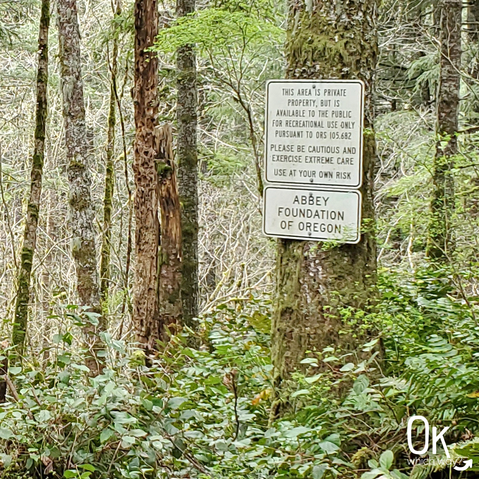
Abiqua Falls is a hidden gem surrounded by the Santiam State Forest. Although open to the public, the falls are on private property owned by the Mount Angel Abbey.
This post may contain affiliate links. When you make a purchase using one of these affiliate links, we get paid a small commission at no extra cost to you.
I will admit the listed .7 mile distance to the falls had me underestimating this hike. It was a bit more of an adventure than I was expecting. For example I was anticipating a 2 mile outing – we walked about 5.
The rugged beauty surrounding Abiqua Falls is my all time favorite. The wet, fern filled, evergreen forest of the Pacific Northwest is my happy place.
Abiqua Falls Trail Stats
Trailhead: Abiqua Falls Trailhead would be the official start, but you may need to begin a mile or so before the trailhead
Trail Type: Out & Back
Difficulty: 🟦 Intermediate due to steep & slippery sections based on OK Which Way’s rating system
Distance: Could be as little as 1.5 miles or closer to 5 if you opt to not park at the trailhead
Elevation: 1160 – 1500 feet
Planning Your Visit
Location: About 40 minute drive from Silverton
Time Zone: Pacific Standard Time
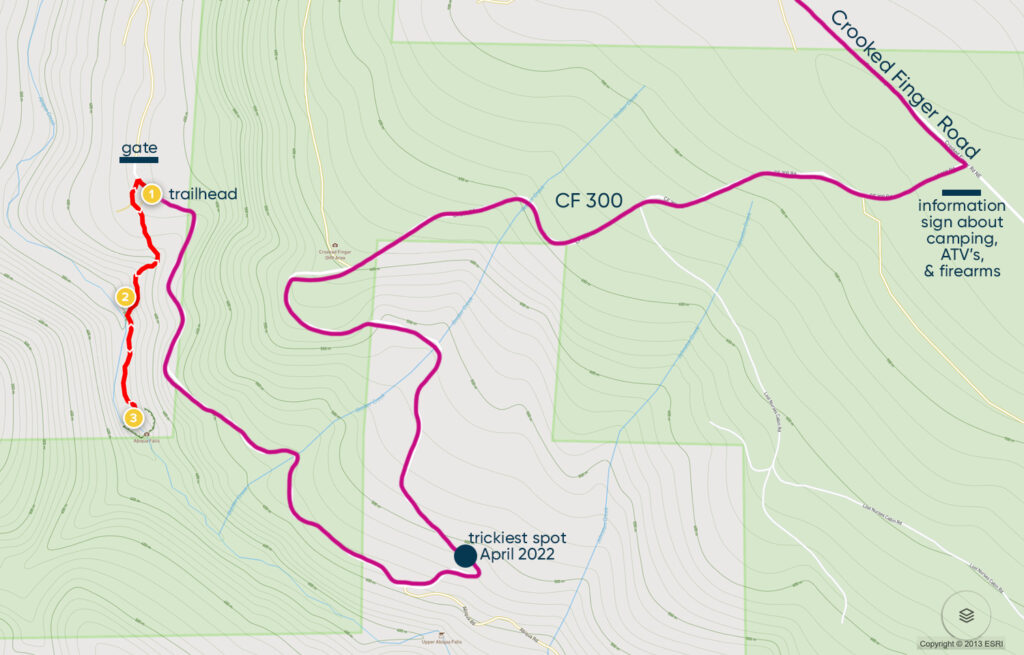
Parking: The closest parking is at the Abiqua Falls Trailhead. However, the final mile or so to the Trailhead is rough, so you might opt to park along CF 300.
Park Pass Needed: none
Entrance Fee: none
Trail Map: Link to trail map
Pets: Dogs are allowed
Getting There
I have read that some people struggled using online maps to reach the trailhead. Thankfully, we didn’t have any trouble using Google Maps. It took us right to the trailhead.
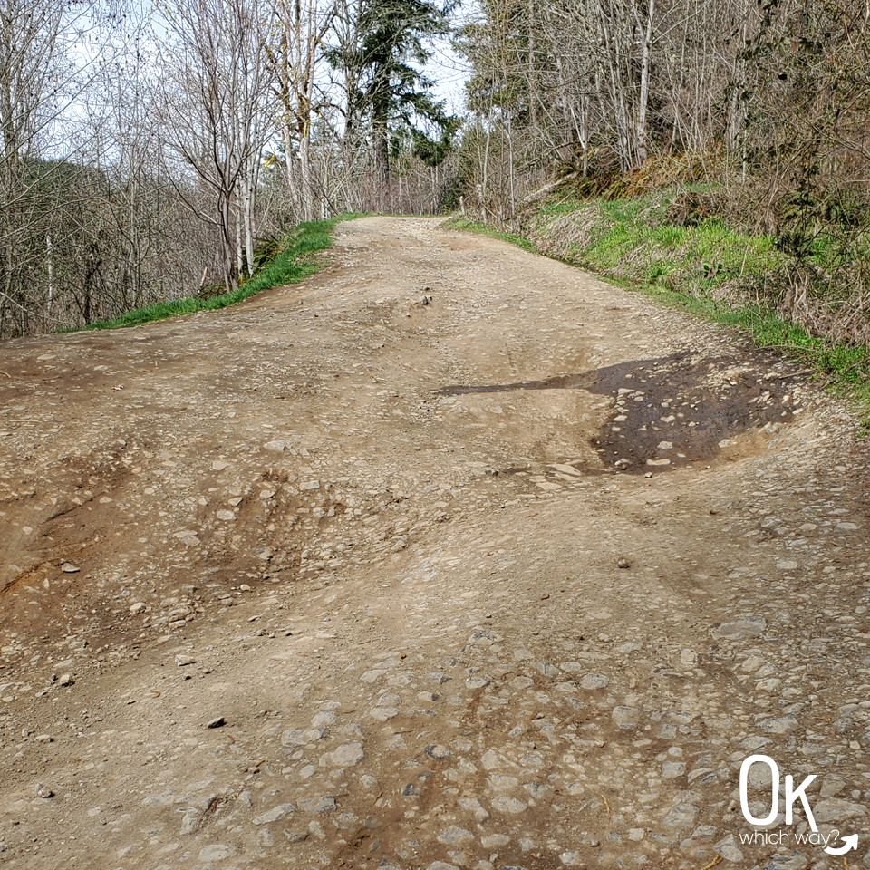
From Crooked Finger Road, you will take a right onto CF 300. It’s not marked, but there is an informational sign at the intersection. Stay on CF 300 and follow it all the way to the trailhead. This forest road is not well maintained, so be aware that you might decide to pull your vehicle over and walk the remaining mile or two to the trailhead.
I had full intentions of driving all the way to the trailhead. I live on an old logging road that is not maintained. I’m used to driving on rough roads. However, I reached a section that I decided wasn’t worth risking and I thought the road might get even worse. So, I turned around and parked on the side of the road just before the troublesome spot. That being said, I probably could have done it. It didn’t get worse and I noticed a couple vehicles maneuver the area problem free.
When you feel you can’t/shouldn’t drive any further, pull over in a wide spot in the road and walk. It’s a lovely road for a walk.
There is no signage anywhere saying you are at the trailhead or pointing towards the falls. So, follow your maps and keep your eyes out for a couple things:
1 – There is a gate blocking the road just passed the trailhead.
2 – Look for the white sign on a tree. That’s the trailhead. Once on the trailhead, head towards the left, not towards the gate.
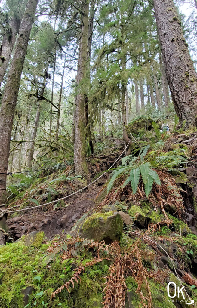
The Trail
The trail down to the creek is relatively short. It’s dirt and narrow and beautiful.
And steep.
You will soon reach the first rope section. It wasn’t too slippery when we hiked it, but I was grateful for the rope.
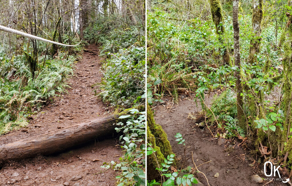
After the first steep spot, you will get a short breather and continue following the path at a slight decline.
When you reach the steepest section, watch your footing, hold the ropes, and guide yourself down towards the creek.
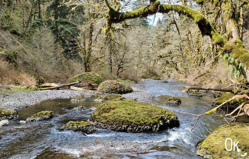
Once you reach Abiqua Creek you will head to the left, following it upstream. The path is rocky and can be slick in spots. Be prepared to step over debris.
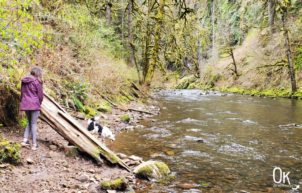
This is one of those photos that just didn’t capture the magic of this spot along the creek. It was green and gorgeous, and I’m sure could be in a scene from a hobbit movie.
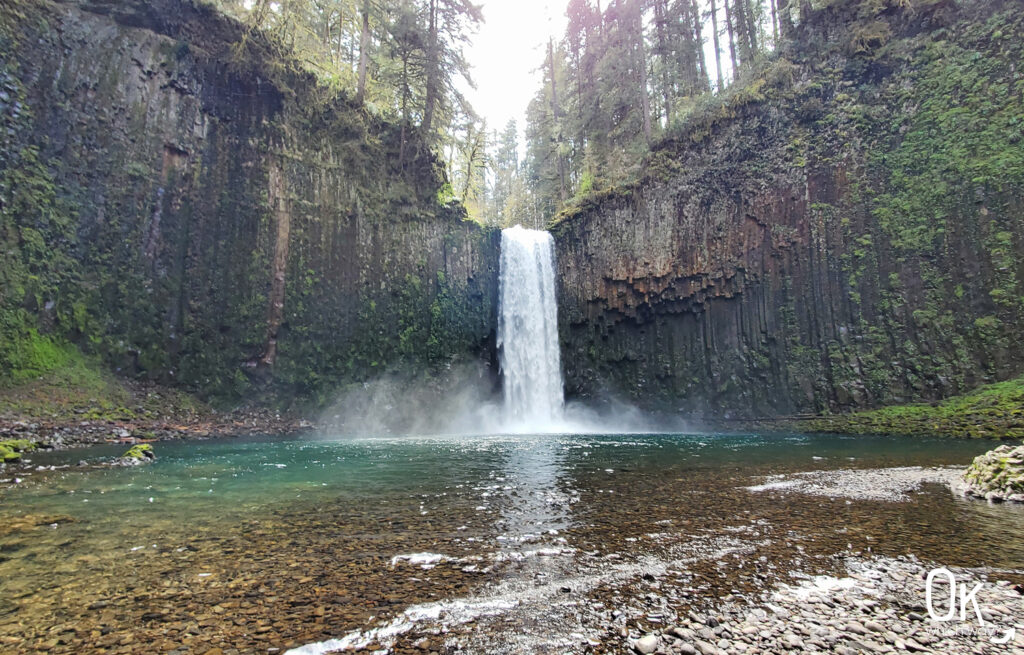
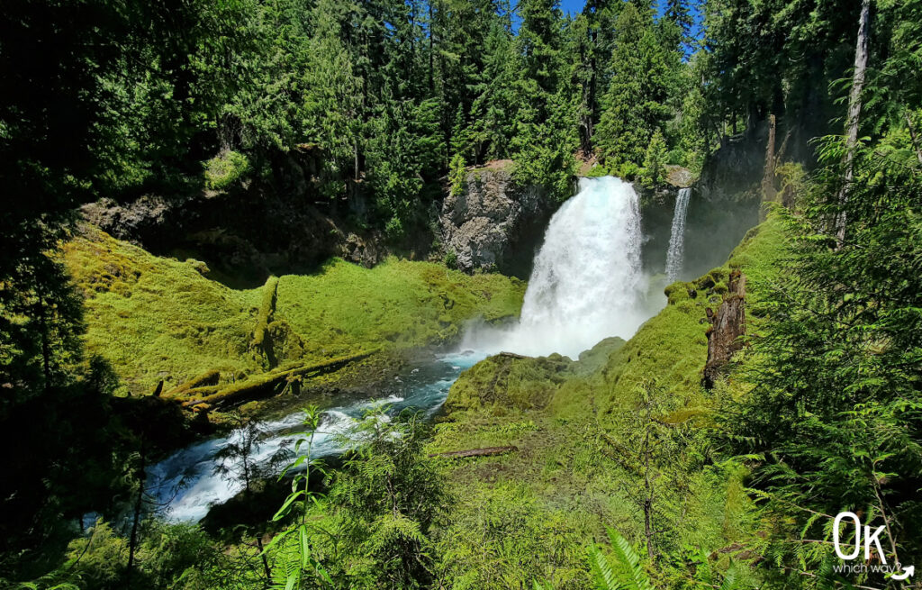
Abiqua Falls
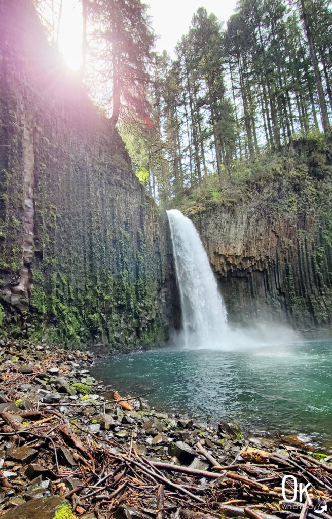
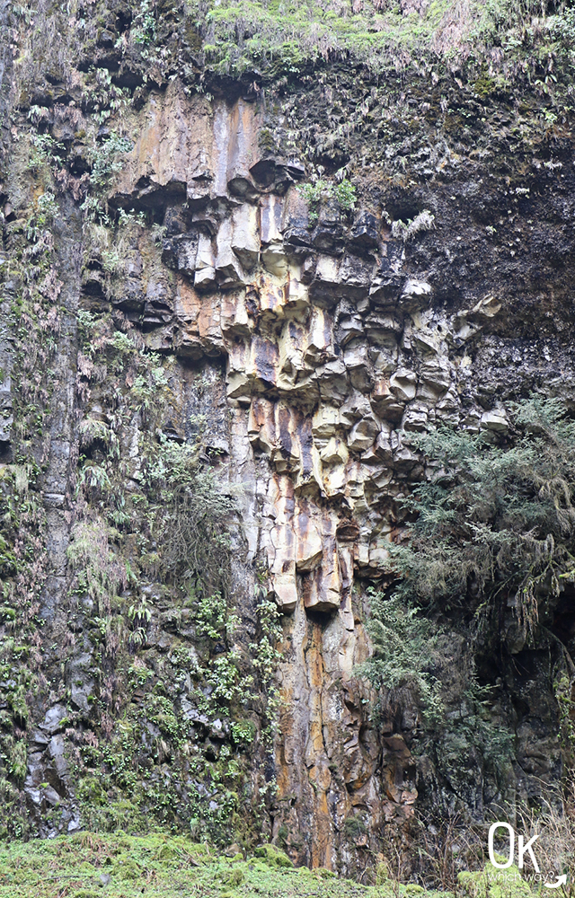
Continue on and you will eventually reach the falls. It is the most enchanting scene. The waterfall crashing into the pool below. The basalt columns covered in moss, ferns, and lichen. It’s just dreamy.
Take some time on the the gravel beach to admire your surroundings.
Abiqua Falls Stats
Waterfall Height: 92 feet
Waterfall Type: Plunge
Watershed: Molalla River
Source: Abiqua Creek
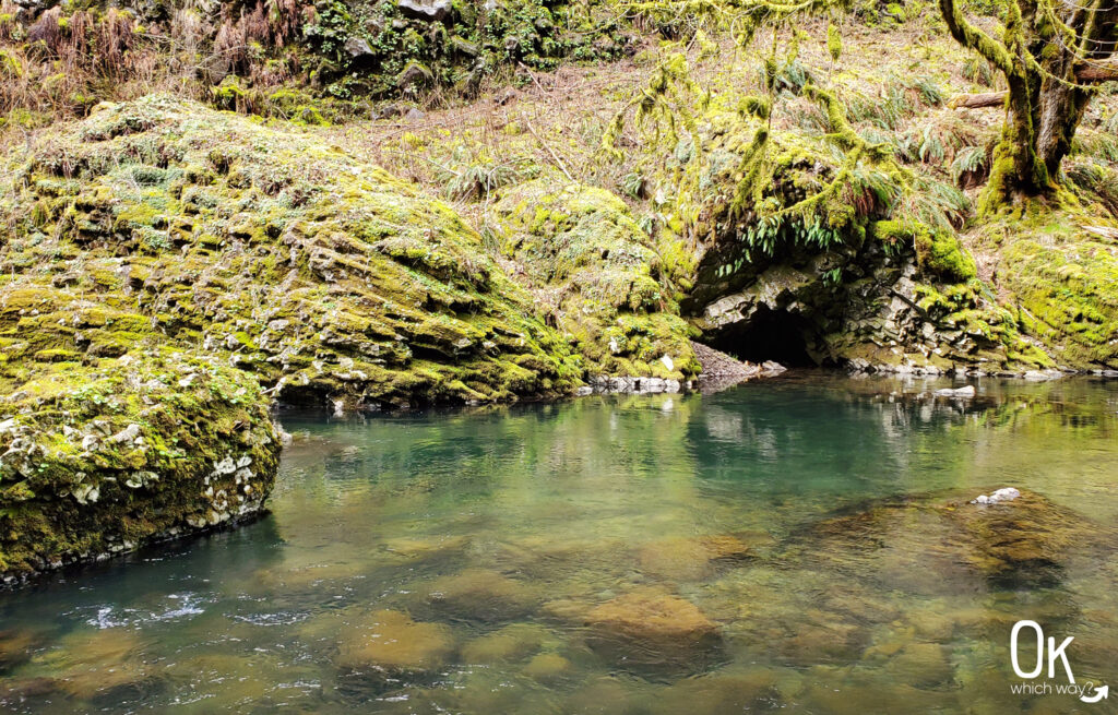
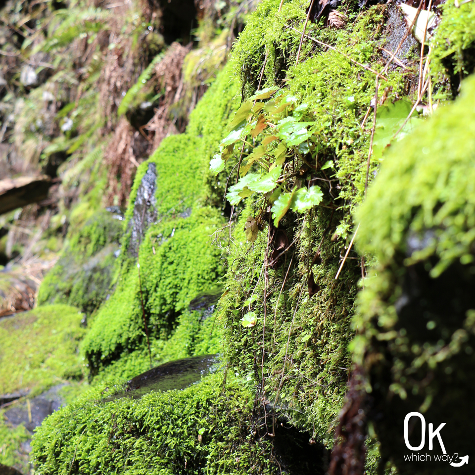
So much life growing on the rocks. ♥
Heading Back
This is an out and back trail, so when you’re ready head back towards your car the same way you came from.
The Little Things – Flora, Fauna, Rock info
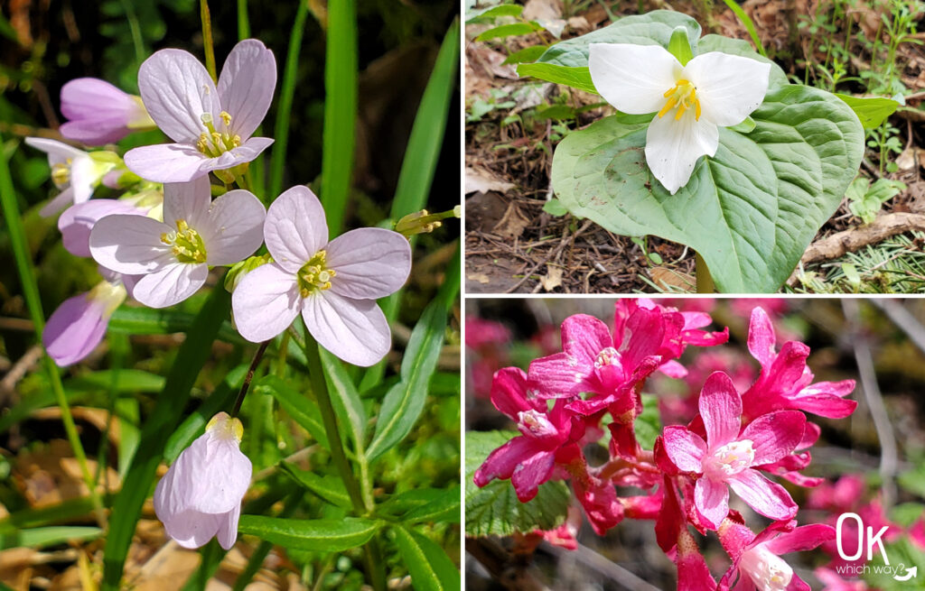
We hiked this trail in the beginning of April and there were spring wildflowers in bloom including trillium and red-flowering currant. Silver Falls State Park is nearby and has similar wildflowers. If you are wondering what flower you saw on your hike, you might find it on this graphic from Silver Falls.
Final Thoughts
The hike wasn’t quite as expected, but it was a beautiful day for an outing. The falls and basalt columns were spectacular. I would love to come back and see the falls just after a dusting of snow has fallen.
LEAVE NO TRACE
Optional Items to Bring
Our Stats
Date: April 2022
Distance: 5ish miles
Start: Near the blue circle on the map below along CF 300
End: Near the blue circle on the map below along CF 300
Hiking Time: 3ish hours
Geology
The basalt rock, including the columns, surrounding Abiqua Falls are part of the Columbia River Basalt Group. Years ago, lava flows oozed over this area. When the thick layer of lava cooled and contracted it formed hexagonal cracks down the lava forming the columns.
Thinking About Hiking to Abiqua Falls?
Pin This to Help Plan Your Trip ⬇
More Outdoor Spaces to Explore in Oregon
This trail review is based only on Jennifer’s experience. Hike at your own risk with the understanding that individual scenarios in a natural environment will be variable.