Black Butte Trail near Sisters, Oregon
Tucked away in the beautiful Deschutes National Forest, right near Camp Sherman and the headwaters of the Metolius River, Black Butte offers a challenging climb with an amazing panoramic view of the volcanoes and evergreen forests of the Cascade Range.
This post may contain affiliate links. When you make a purchase using one of these affiliate links, we get paid a small commission at no extra cost to you.
Black Butte Trail Stats
Trailhead: Black Butte Trailhead
Trail Type: Out and Back
Difficulty: 🟦 Intermediate – primarily due to the elevation gain; based on OK Which Way’s rating system
Distance: 4 miles
Elevation: 4850 feet – 6370 feet
FUN FACT: Black Butte is a stratovolcano. It was formed by layers of lava and ash, giving it that classic cone shape.
Planning Your Visit
Location: 3 hours from Portland, 30 minutes NW of Sisters
Time Zone: Pacific Standard Time
Seasonal Closures: Although the trail is not closed in winter, vehicle access is limited
Parking: Black Butte Trailhead
Park Pass Needed: Federal recreation pass is required such as NPS America the Beautiful Pass or NW Forest Pass
Entrance Fee: $5/car check the Forest Service website for current fee pricing
Trail Map: Link to AllTrails map
Pets: Dogs on leashes permitted
Driving to Upper Black Butte Trailhead
From Highway 20 turn onto Forest Service Road 11. After driving almost 4 miles, take a right onto Forest Service Road 1110. A high clearance vehicle would be ideal as the last few miles are rough.
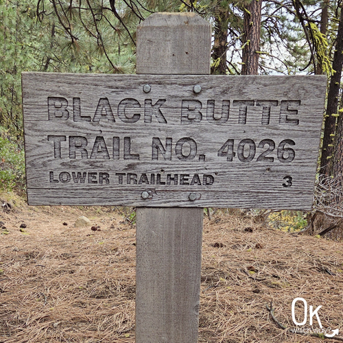
Black Butte Trailhead
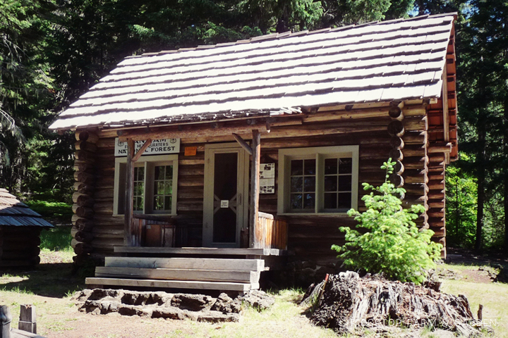
Nearly 10 miles after turning off Highway 20, you will reach the parking lot. It’s not large, so arrive early on particular busy weekends. I’m happy to report, there is a restroom. The trail begins right behind the informational sign.

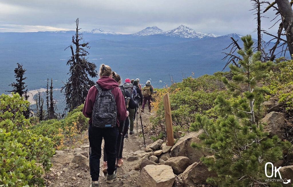
The Climb
Right from the start, you’ll enjoy a classic Central Oregon experience as the trail begins its climb through a gorgeous section of old-growth Ponderosa pines.
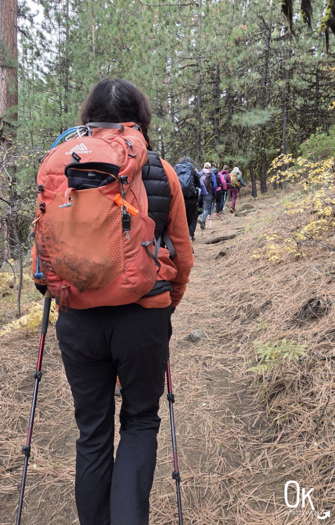
This is a decent climb, but thankfully, you’re distracted by the amazing sneak peeks of the Cascade Mountains.


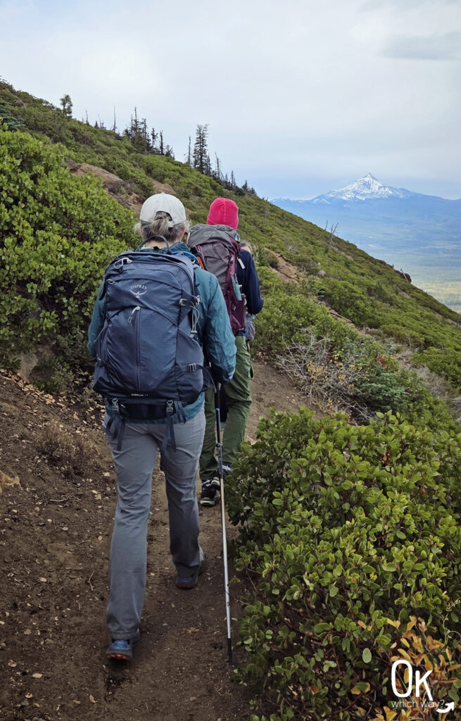
As the climb continues the pines disappear and the slope is exposed. Keep an eye out for local flora along the way, like the low-growing Pinemat Manzanita and the Saskatoon Serviceberry.
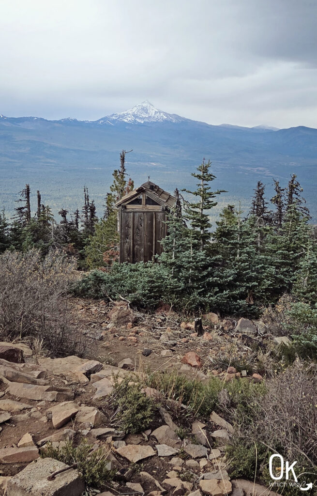
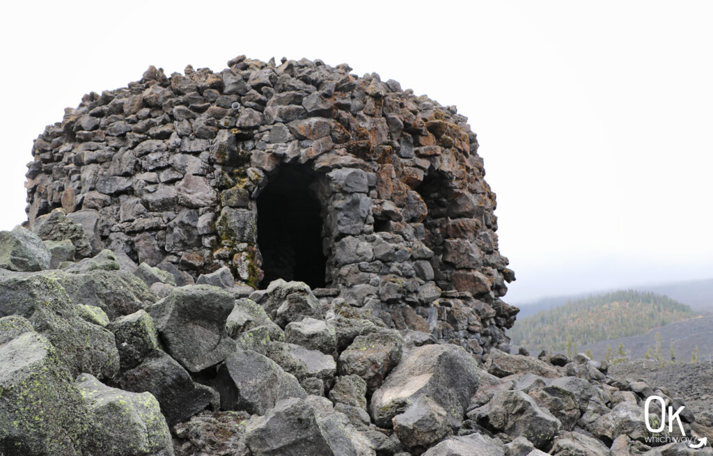
The Black Butte Summit
When you reach the rocky summit, you will first notice the active lookout tower. To reach the viewing platform, though, head towards the old D-6 Cupola Lookout built in 1922.
The summit is exposed so be prepared for little relief from the sun and wind.
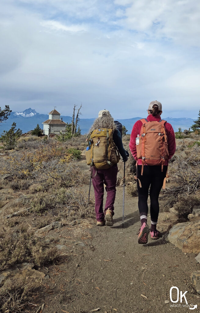
The viewing platform offers breathtaking, uninterrupted views of the Cascade Range. On a clear day you can see:
-
Mt. Adams
-
Mt. Hood
-
Mt. Jefferson
-
Three Fingered Jack
-
Mt. Washington
-
Belknap Crater
-
North Sister
-
South Sister
-
Broken Top
FUN FACT: Black Butte became the first fire lookout site in the Deschutes National Forest back in 1910. Before the towers, they used two trees as lookouts.
Black Butte has a deep history as a crucial fire lookout point, and is listed on the National Historic Lookout Register. Back in 1934, men from the Civilian Conservation Corps built an enormous 83-foot wooden tower here. It was the predecessor to the current one, but was eventually condemned in 1993 and collapsed a few years later.

Heading Down Black Butte
The view is pretty spectacular as you head back down the butte.
Black Butte Fires
Black Butte has had a couple of dramatic, lightning-caused fires, including the 1981 blaze that burned 235 acres and another one in 2009 that consumed 578 acres. Nature is tough, and it’s nice to see the forest recovering.


As you get closer to the trailhead, the towering Ponderosa pines reappear, welcoming you back and sheltering you from the elements.

Final Thoughts
Black Butte is a definite favorite. It’s challenging, full of history, and totally worth the sweat. You’ll love the transition from hiking beneath the Ponderosa pines to the openness of the subalpine terrain. For amazing views of the Cascade Mountains, this hike should be on your Central Oregon to-do list.
LEAVE NO TRACE
Optional Items to Bring
Our Stats
Date: October 2025
Distance: 4.08 miles
Start: Black Butte Trailhead
End: Black Butte Trailhead
Hiking Time: 2hrs 41min

McKenzie Pass – Santiam Pass Scenic Byway

Black Butte sits just off the Santiam Pass section of the McKenzie Pass – Santiam Pass Scenic Byway. The route creates a loop traveling to Sisters, then heads west on the McKenzie Pass, north onto Hwy 126, and finally east returning along the Santiam Pass.
*note: parts of the byway are closed during winter
Thinking About Hiking to the top of Black Butte?
Pin This to Help Plan Your Trip ⬇

More Places to Explore in Central Oregon
This trail review is based only on Jennifer’s experience. Hike at your own risk with the understanding that individual scenarios in a natural environment will be variable.