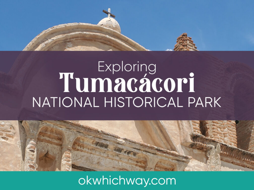
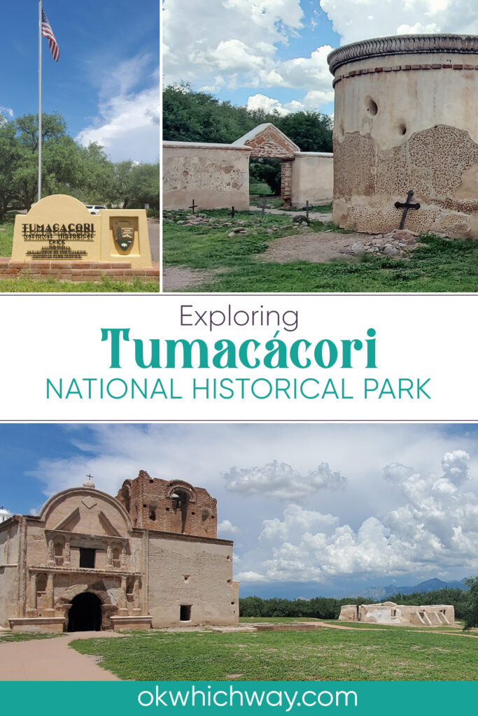
Exploring Tumacacori National Historical Park
Tumacácori National Historical Park preserves the stories of indigenous people and Spanish exploration. Situated along the Santa Cruz River, the area was home to the O’odham, Yaqui, and Apache people. Spanish culture was introduced to the area by European Jesuit and Franciscan missionaries. Today we can take a self guided tour of the church and village ruins.
This post may contain affiliate links. When you make a purchase using one of these affiliate links, we get paid a small commission at no extra cost to you.
Park Info
Location: Southern Arizona. About 45 minutes south of Tucson and 20 minutes north of Nogales
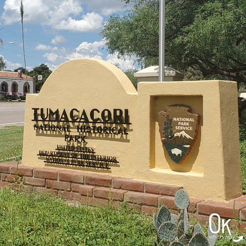
Established: Tumacácori National Monument was established in 1908. It is now a National Historical Park.
Time Zone: Mountain Standard Time. Except for the Navajo Nation, Arizona does not observe daylight saving time
Driving Info: Be prepared for a border patrol checkpoint along I-19, if coming from Tucson
Lodging/Camping: None on site
Food: None on site
Entrance Fee: $10 per person – check the NPS website for current fee pricing
Pimeria Alta
By the late 1600’s, the area known as Pimería Alta (in what today is part of southern Arizona and northern Sonora, Mexico) had multiple O’odham communities. Over twenty Catholic missions were built by New Spain in this area as a way to convert the O’odham people to Christianity. Some of the churches are still operating today, such as San Xavier del Bac in Tucson.
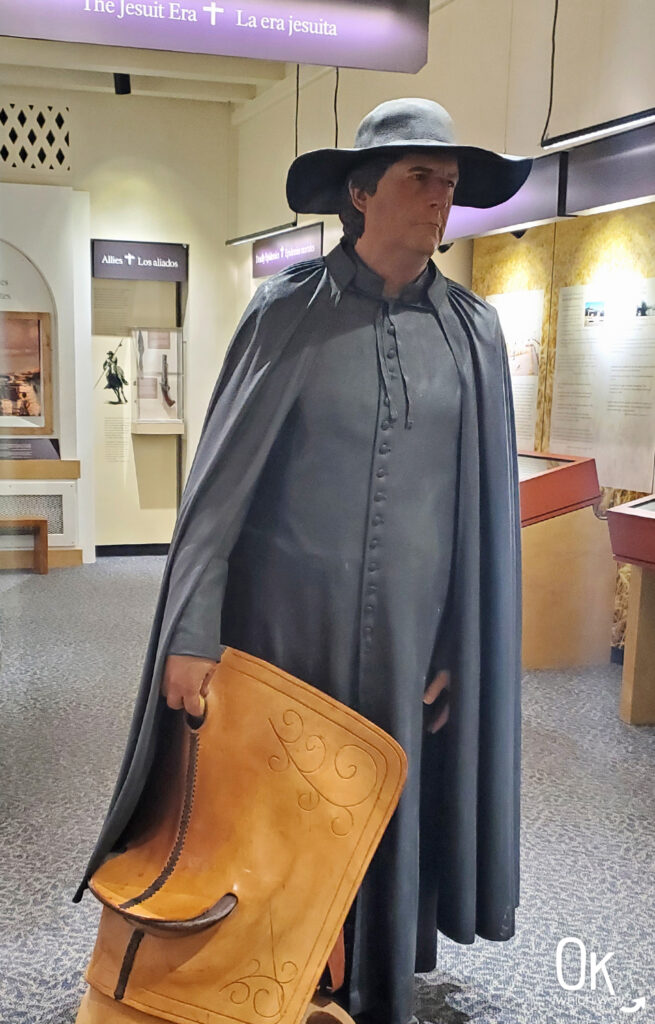
Visitor Center & Museum
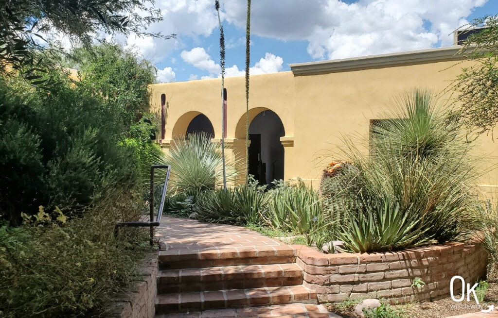
Your first stop when entering Tumacácori will be the visitor center. Here, you will pay your admission and grab the self guided tour information. There is a small bookstore with a few items for sale, as well as the cancellation stamp for your passport book.
Being constructed during the New Deal era, multiple Civilian Conservation Corps camps in the area contributed to the building of the visitor center building and courtyard. The men carved signs, designed the front doors, planted trees, and installed the flagpole.
FUN FACT: Tumacácori’s visitor center and museum is designed in the style of a Sonora mission with reproductions of doors, windows, floors, and ceilings. The significant features have placed the building as a National Historic Landmark.
Courtyard
Museum
The museum tells the story of the Santa Cruz Valley with exhibits about the native people, the missions, and natural elements.
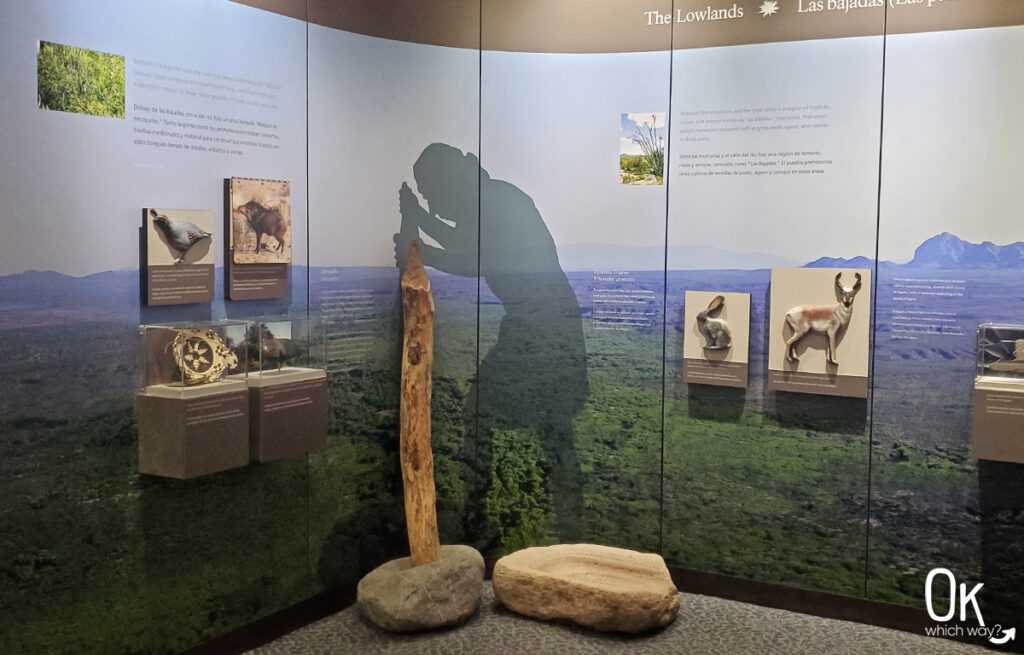
Coming from New Spain (present day Mexico) in 1691, Padre Eusebio Kino was the first Jesuit priest to connect with the O’odham. The mission established at Tumacácori was just one of more than 20 missions in the area designed to teach European ways of life to the people living on land claimed by Spain.
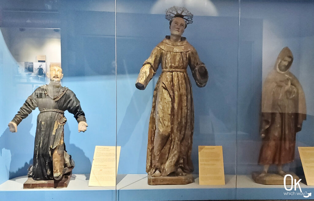
Much of the church’s original artifacts are gone, but six of the statues are housed within the museum.
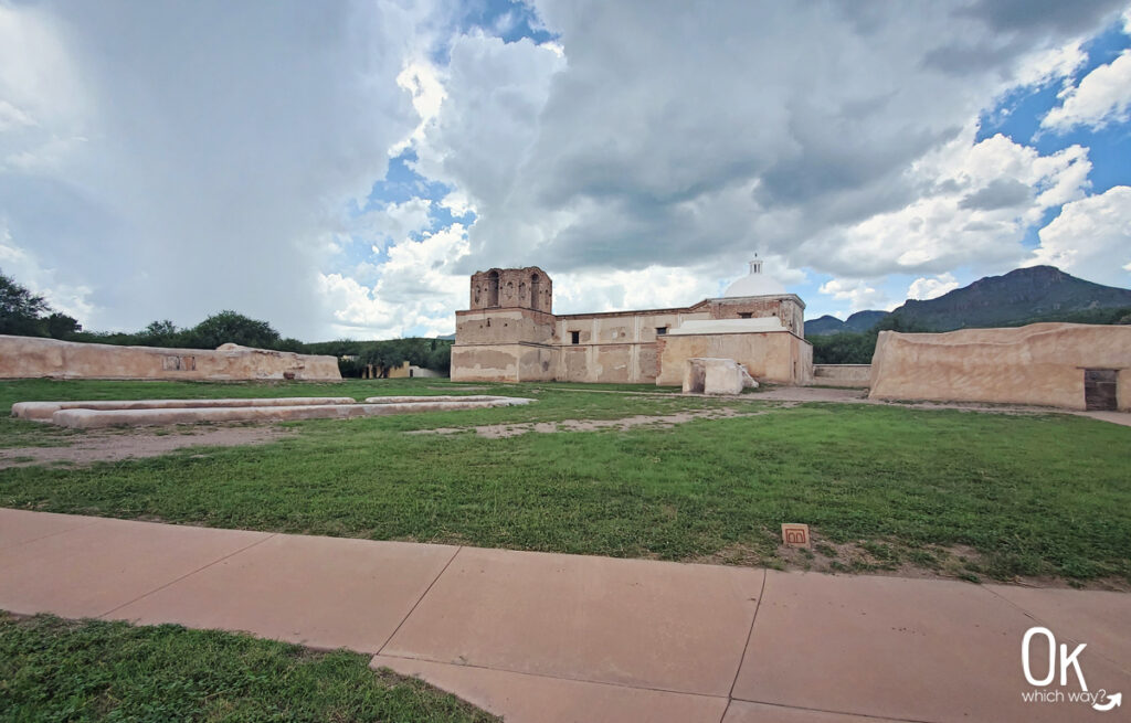
Mission San José de Tumacácori
There are a number of places to visit during the self guided tour of the mission grounds. Each site tells part of the 150 year story during the mission era of the park.
Tumacácori was designated a Catholic visita in 1691. The first mission structure was built on the south side of the Santa Cruz River with no priest living onsite. The priest from the nearby Guevavi mission attended mass at Tumacácori and tended to mission business.
The Spanish and O’odham lived peacefully for years, until the O’odham felt too much was being taken them. In 1751 the O’odham coordinated an attack on the Spanish missions resulting in over 100 people dead. When the fighting ended, a presidio was built nearby at Tubac and the Tumacácori mission was rebuilt at the current location.
The Jesuits in Sonora and Sinaloa were accumulating wealth and power for their order. This power, as well as being loyal to the pope in Rome, caused King Carlos III of Spain to have 52 missionaries arrested in 1767. They were held for nine months in a warehouse, shipped to Baja California, and forced to walk to Mexico City before being shipped to Europe. Twenty of the priests died before ever reaching Mexico City.
With the Jesuits being gone, the Franciscan Order took over the missions and soon the headquarters moved from Guevavi to Tumacácori. And with it, a priest onsite.
In the early 1800’s a new church was being built. But, due to lack of funding it was never complete.
Mexico gained independence from Spain in 1821, which resulted in a shortage of priests to manage the missions. In 1828, Tumacácori returned to being a visita – a community where visitors stop, but no priest is in residence.
In December 1848, Tubac and Tumacácori are abandoned.
In 1853, with the Gadsden Purchase, Tumacácori becomes part of the United States.
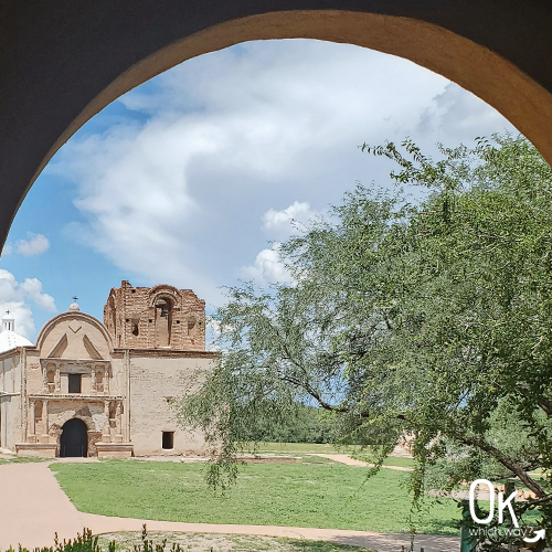
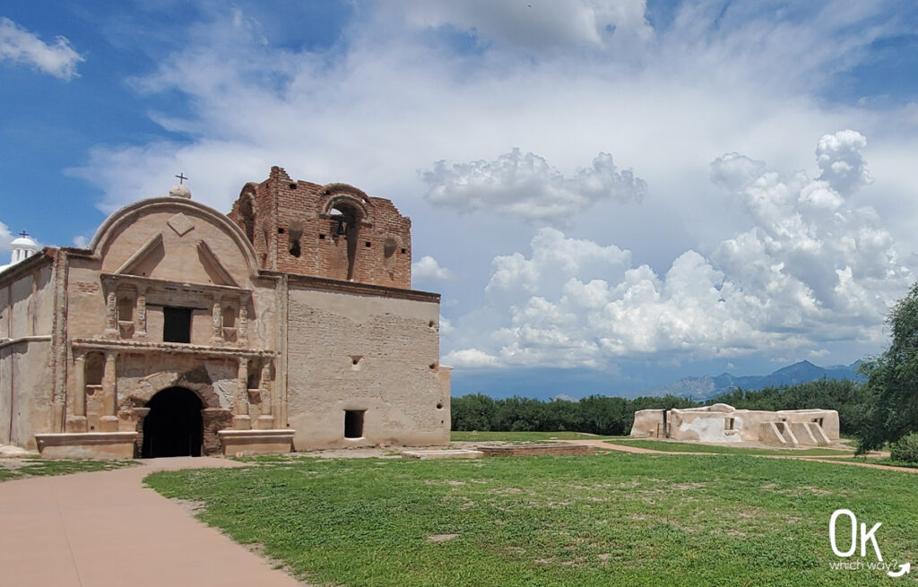
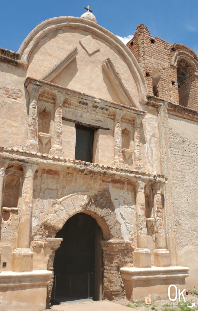
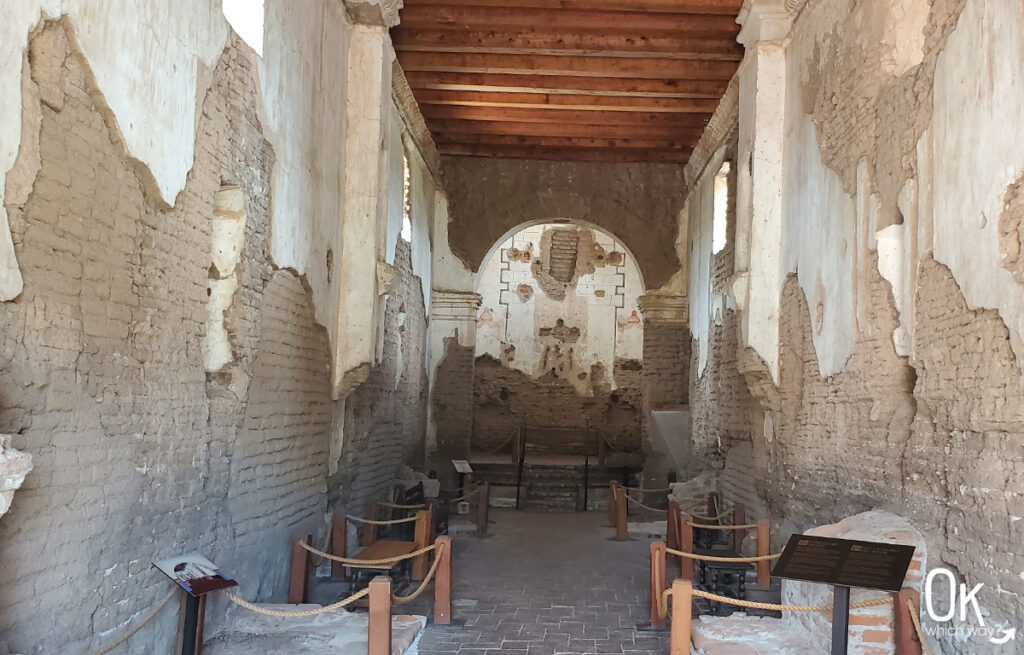
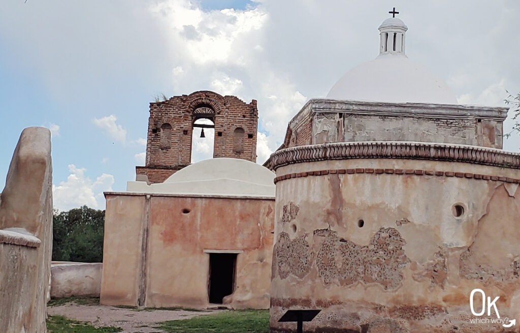
The Church
Although it looks much older, construction on the new church began in 1800. It opened in 1822 with services spoken in a combination of Latin, Spanish, and O’odham. Church goers stood and knelt in the long hall, as there were no pews. Along the walls are altars for candles and niches that held statues of saints. Faded paint from embellishments can still be seen in the sanctuary.
After Tumacácori was abandoned, locals removed the timbers from the roof. The church remained without a roof for 70 years.
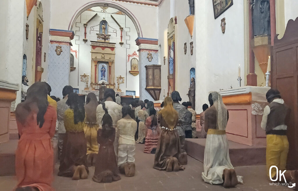
Not only was the visitor center built during the New Deal era, the original museum exhibits were created during this time as well. There were three dioramas created in the 1930’s including this one of the church as it may have looked during mass.
Convento Complex, Storeroom, & Jesuit Church Footprint
The low rectangular shaped border in the grass is the outline of the first church built in the 1750’s. It was used until the bigger church was ready in 1822.
Cemetery
Between 1755 and 1825, nearly 600 burials were recorded at Tumacácori with the majority of them being children under the age of five. The graves from this time have been destroyed.
The markers visible today are from those who came to the area in the late 1800s and early 1900s.
The 16 foot diameter circular building in the center of the cemetery was the mortuary chapel and along the cemetery walls are 14 niches that once held paintings or sculptures of the Catholic Stations of the Cross.
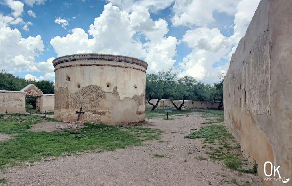
FUN FACT: In the late 1800’s the cemetery was used as a cattle corral
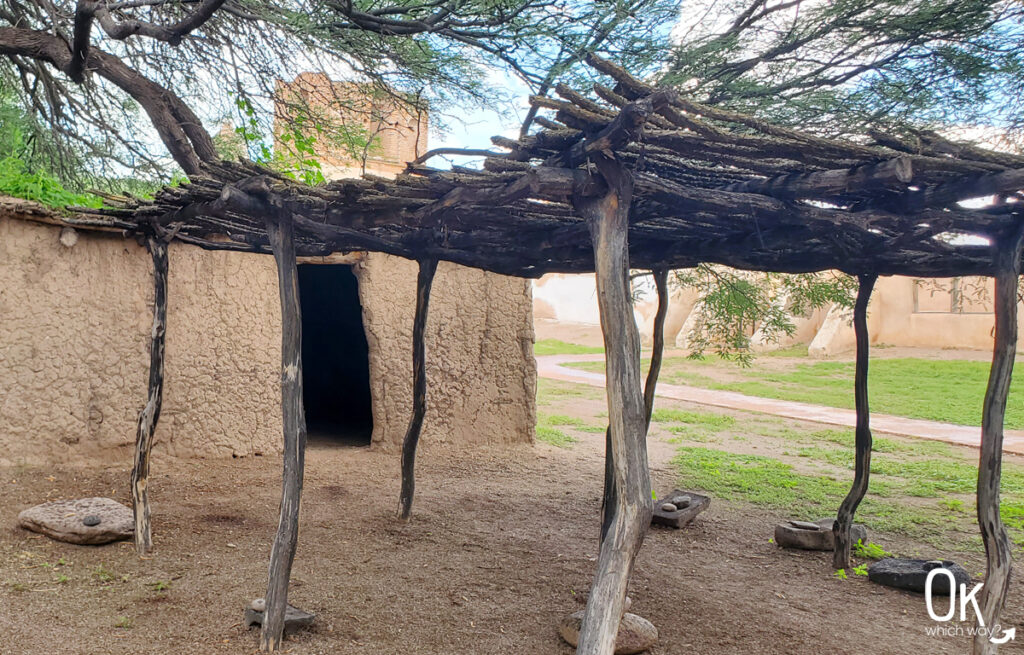
Melhok ki
Melhok is the O’odham word for ocotillo and ki is the O’odham word for house.
Lime Kiln
Calabazas and Guevavi Missions
Tumacácori National Historical Park also protects the ruins of the Calabazas and Guevavi missions. These two missions can only be seen while on a 4 hour guided tour.
Los Santos Ángeles de Guevavi was established by 1701and abandoned in 1775.
San Cayetano de Calabazas was established in 1756 and abandoned in 1878.
Hiking the Anza Trail
The 1200 mile Juan Bautista de Anza National Historic Trail follows the route traveled by Anza and colonists from 1774 – 1776. The expedition started in Culiacan, Sinaloa, Mexico and ended in San Francisco to establish a mission and presidio. Currently, it is not possible to hike the entire distance. But, there is a 4 mile walkable section that follows the Santa Cruz River from Tumacácori National Historical Park north to Tubac Presidio State Historic Park.
Flora & Fauna
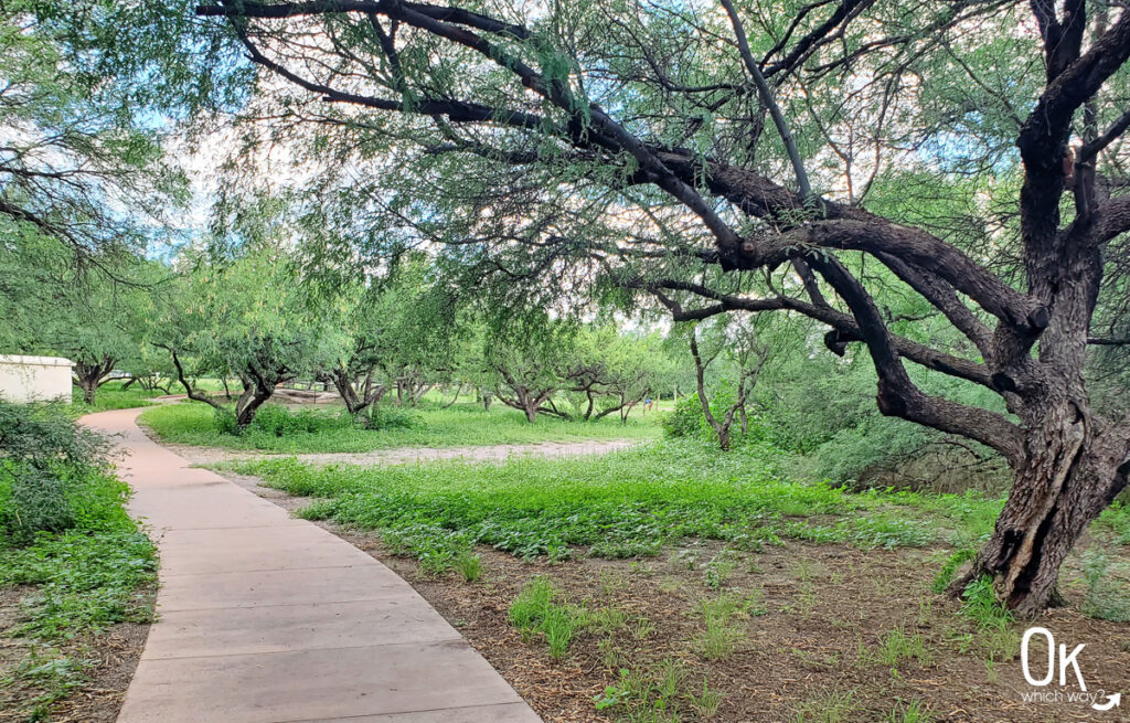
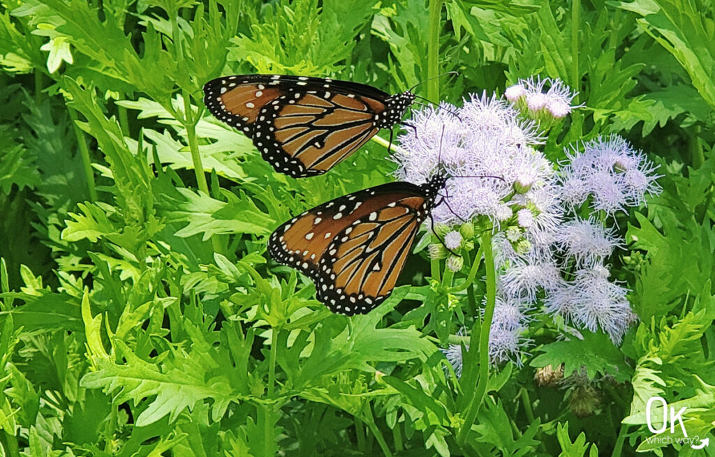
Located in the Santa Cruz River Valley, Tumacácori’s riparian environment and mesquite bosque include a variety of small trees, shrubs, cacti, succulents, grasses, and wildflowers. This semi-desert habitat is home to a range of insects, amphibians, reptiles, over 200 bird species, and mammals including coyotes, javelinas, and mountain lions. When we visited there were many monarchs in the garden in front of the visitor center.
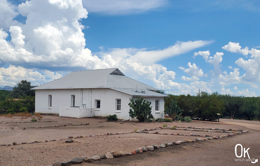
Tubac Presidio
Less than a 10 minute drive from Tumacacori is Tubac Presidio State Historic Park. Operating by 1753, Tubac is the oldest Spanish Presidio in Arizona. The park preserves the ruins of the Presidio, as well as other buildings including an 1885 schoolhouse.
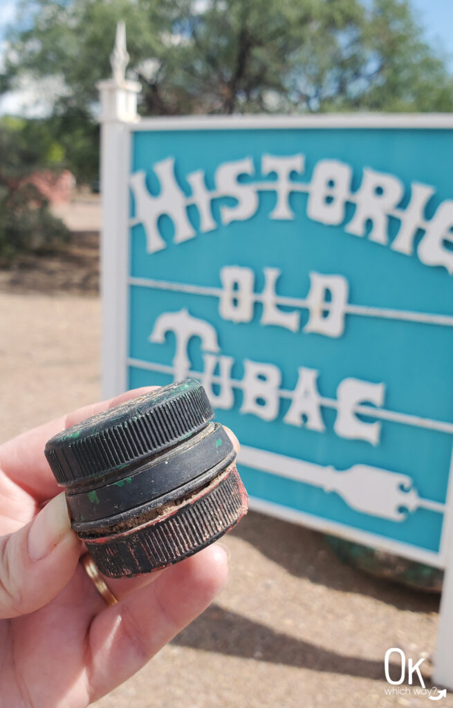
Geocache
For those who enjoy geocaching, there is one hiding near the State park.
If you take the time to find the cache or visit the park, be sure to check out the town of Tubac with its unique shopping and galleries.
Optional Items to Bring
I Hike for Health Pins
Stop by a visitor center to learn the requirements to earn an I Hike for Health pin at a few sites in southern Arizona:
LEAVE NO TRACE
International Dark Sky Park ✬彡
Tumacacori National Historical Park has exceptional starry nights and is a designated International Dark Sky Park.

Anza Expedition
Campsite #14/106
at Tubac Presidio
October 1775
Thinking About Exploring Tumacacori National Historical Park?
Pin This to Help Plan Your Trip ⬇
More Places to Explore in Arizona

This information is based only on Jennifer’s experience. Enjoy at your own risk with the understanding that individual scenarios in a natural environment will be variable.