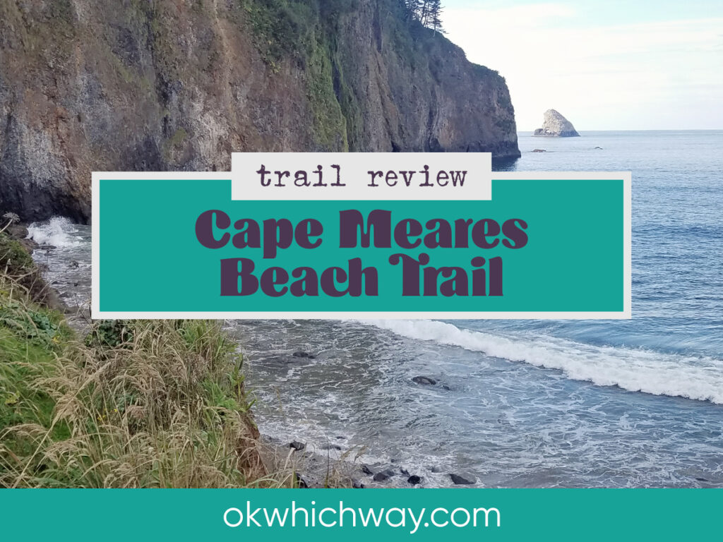
Cape Meares Beach Trail in Oregon
Cape Meares is a popular place to visit. Guests come to see the lighthouse and the amazing views. Less popular, though, is the Cape Meares Beach Trail that is located within a National Wildlife Refuge. The round trip hike is less than 2 miles, but it is primarily one mile down, then the unfortunate one mile back up.
This post may contain affiliate links. When you make a purchase using one of these affiliate links, we get paid a small commission at no extra cost to you.
Cape Meares Beach Trail Stats
Trailhead: Cape Meares Beach Trailhead
Trail Type: Out and Back
Difficulty: 🟢 Moderate based on OK Which Way’s rating system
Distance: 1.85 miles
Elevation: Sea Level – 500 feet
Planning Your Visit
Location: Cape Meares. About 20 minutes from Tillamook and an hour and a half from Portland.
Address: 2375 Cape Meares Loop, Tillamook
Time Zone: Pacific Standard Time
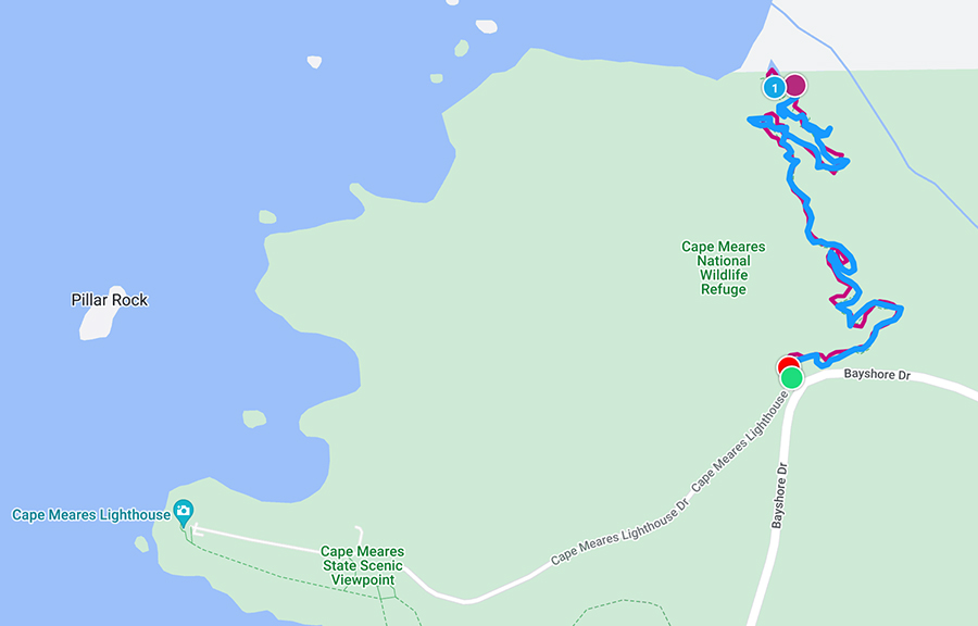
Parking: The trailhead is located right off Bayshore Drive, right before the turn to head towards the lighthouse. There are two trails at this location. One heads towards Big Spruce, the largest Sitka Spruce in Oregon. The other goes down to the beach – which is the trail I took.
Park Pass Needed: none
Entrance Fee: none
Trail Map: Link to AllTrails map
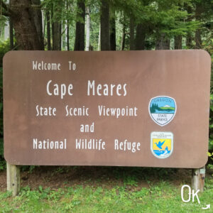
FUN FACT: Cape Meares National Wildlife Refuge was established in 1938
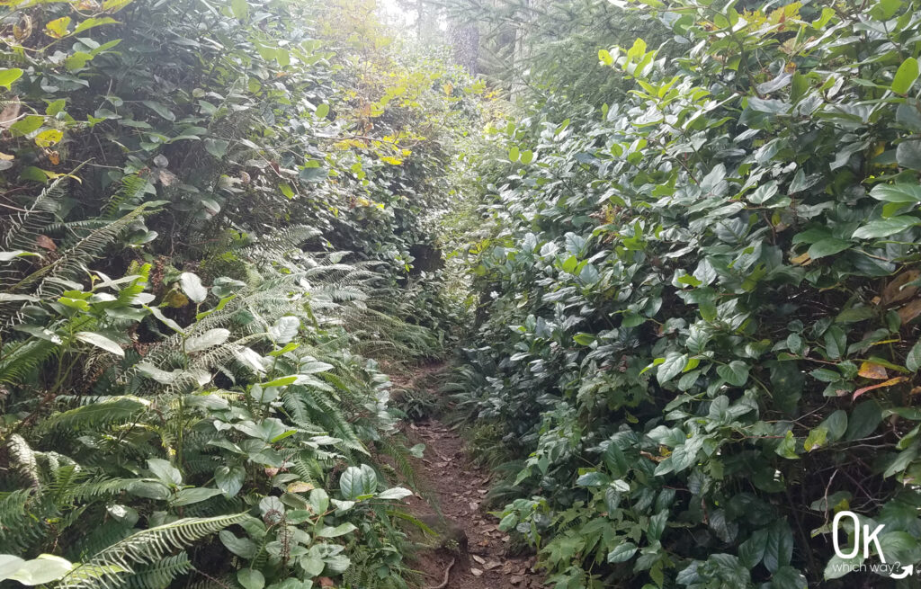
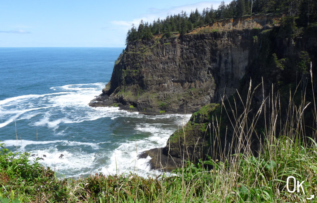
Going Down to the Beach
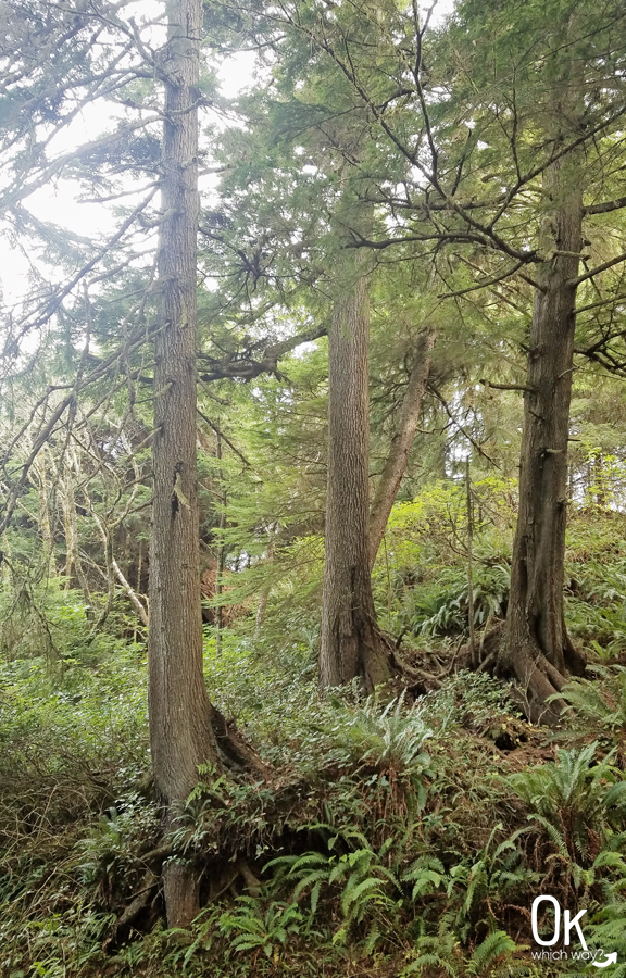
The trail is a narrow, dirt path down to the water’s edge. Watch for obstacles such as tree roots and branches. I hiked this trail in mid October. Later in winter the trail can get extremely muddy.
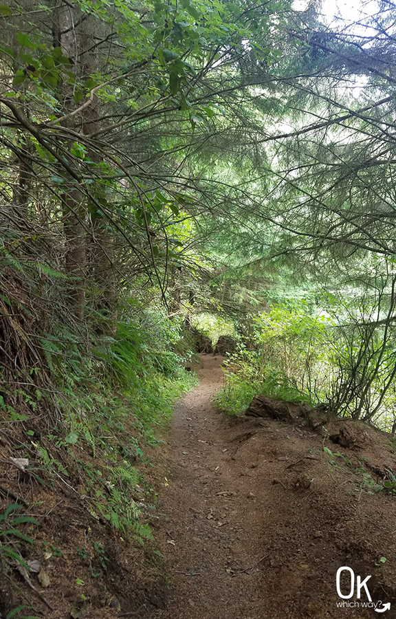
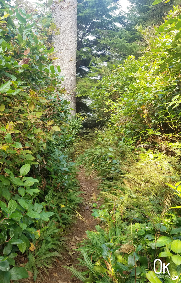
The trail seemed to get narrower and narrower.
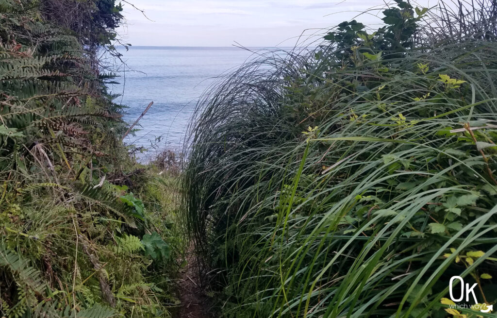
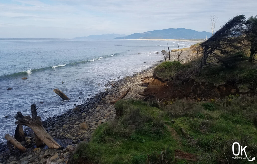
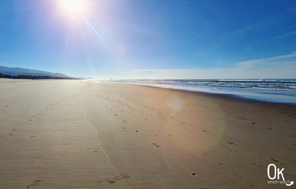
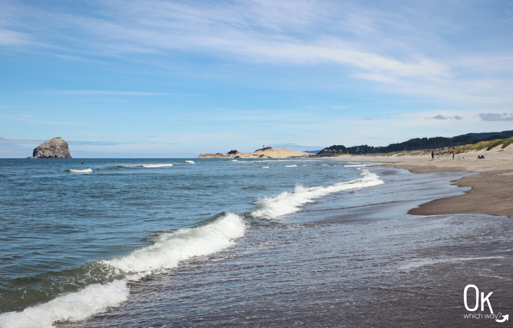
The trail leads right to the water, with a view of Pyramid Rock.
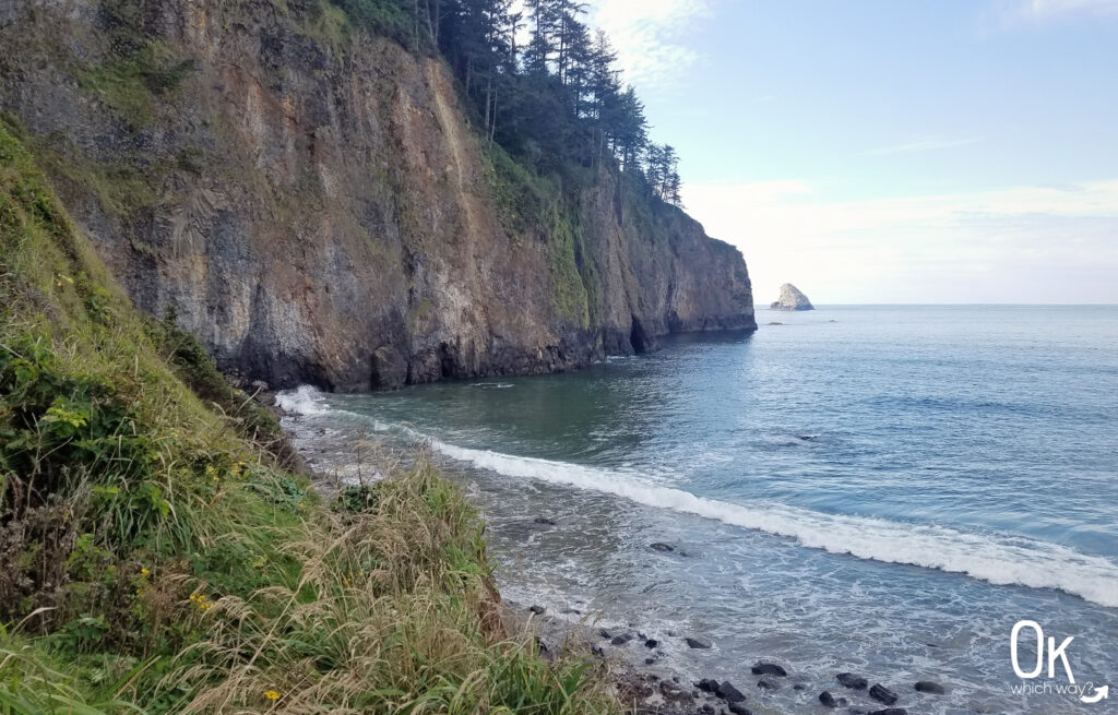
Looking north towards Cape Meares Beach and Barview Jetty.
Going Up
This is an out and back trail, so after taking in the magic of the ocean I hiked back up the path I just came down. It’s moderately steep, but I was able to keep an ok pace all the way.
Final Thoughts
This is a nice trail that doesn’t tend to get many hikers. I would like to hike it again and spend more time at the secluded beach.
LEAVE NO TRACE
Optional Items to Bring
Our Stats
Distance: 1.85 miles
Start: Cape Meares Beach Trailhead
End: Cape Meares Beach Trailhead
Hiking Time: 47min*
*A quick note on our hiking style – We stop and smell the roses. When I go for a run, speed is a consideration. While hiking, it is not. We take photos, watch the chipmunk in the tree, find geocaches, and simply enjoy the adventure. So, typically a hike can be completed in a shorter time than we log.
52 Hike Challenge
I work best when I have a goal to reach towards. In 2019, the goal was 52 Hikes.
Hike 39 of 52: Cape Meares Beach Trail

Thinking About Hiking the Cape Meares Beach Trail?
Pin This to Help Plan Your Trip ⬇
More to Explore at the Oregon Coast
This trail review is based only on Jennifer’s experience. Hike at your own risk with the understanding that individual scenarios in a natural environment will be variable.