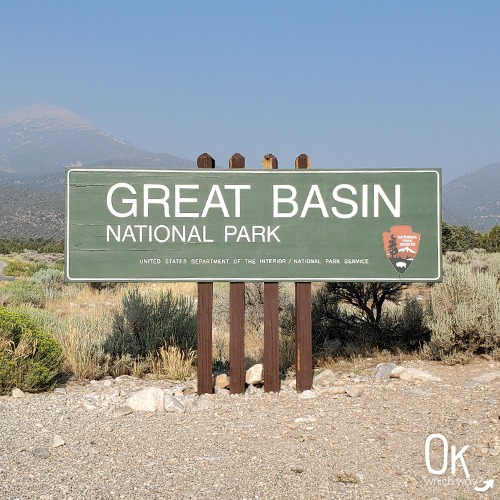
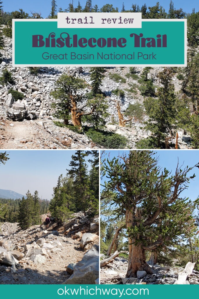
Hiking the Bristlecone Trail in Great Basin National Park
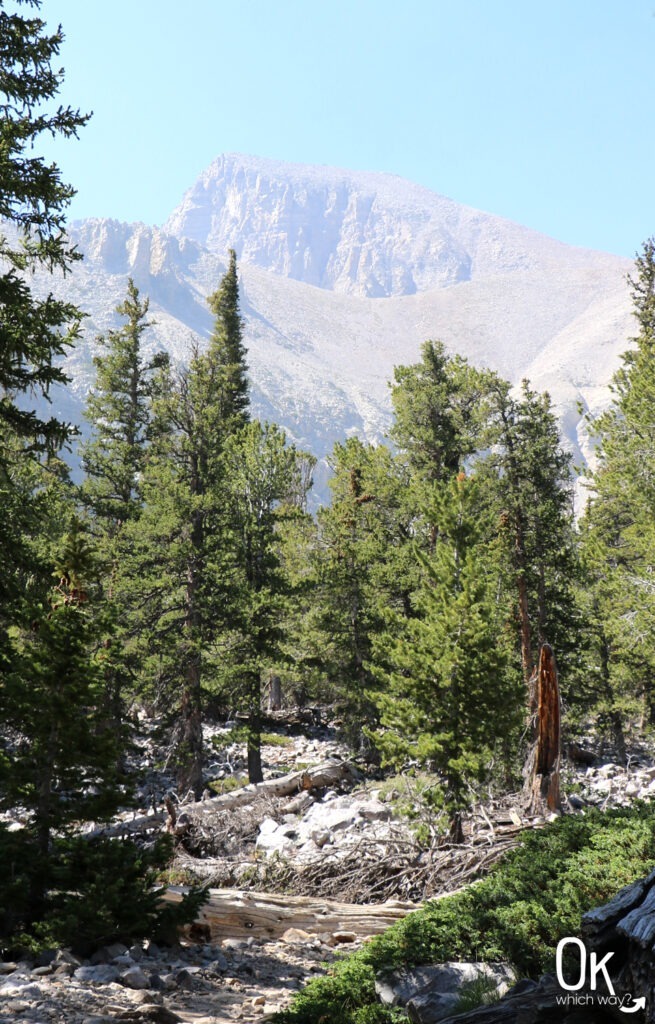
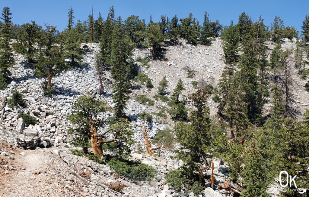
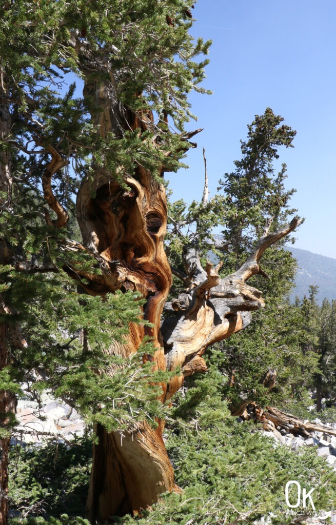
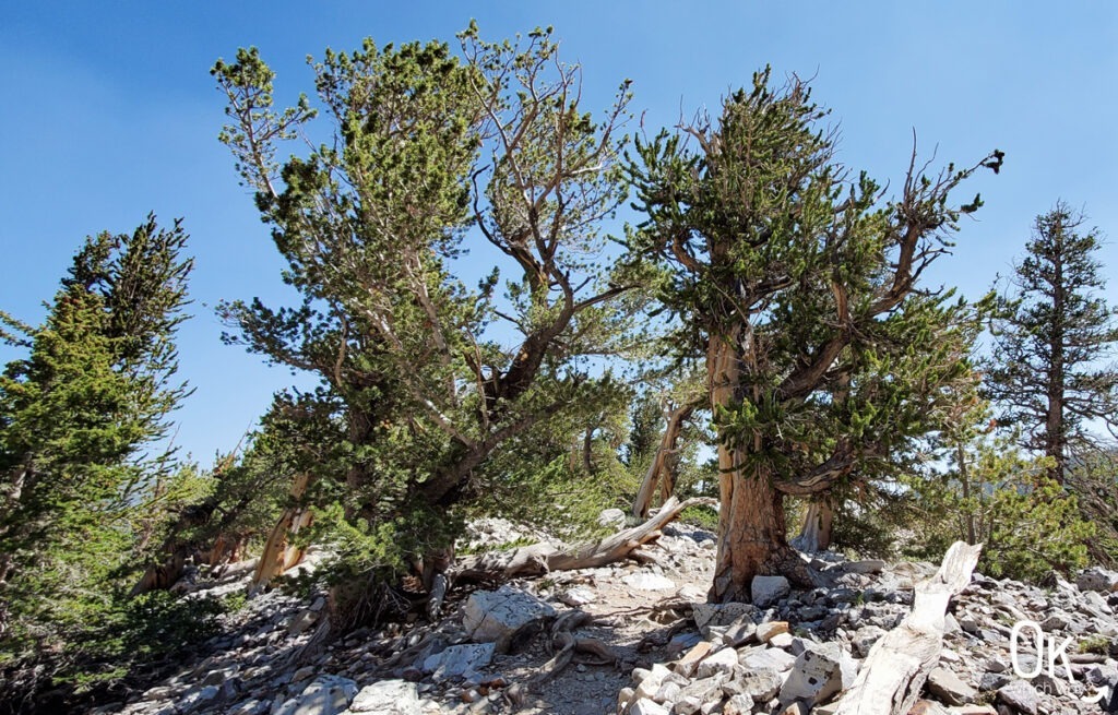
The hike to the bristlecone pine grove in Great Basin National Park is a relatively short, but impressive, trek into the high elevations of the Snake Range. This trail leads you to a glacial moraine of quartzite boulders where the Great Basin Bristlecone Pines thrive. These are a rare species found only in Nevada, California, and Utah, making the Wheeler Peak grove an ecological treasure. The Bristlecone Trail leads you through the grove for a close up look at these twisted, ancient trees that have been around for thousands of years.
This post may contain affiliate links. When you make a purchase using one of these affiliate links, we get paid a small commission at no extra cost to you.
Bristlecone Trail Stats
Trailhead: Bristlecone Trailhead
Trail Type: Out and Back
Difficulty: 🟦 Intermediate – Based on OK Which Way’s rating system, this hike would be rated as moderate, however I am increasing it to intermediate due to the high elevation
Distance: 2.8 miles
High Elevation: 9890 – 10,490 feet
Planning Your Visit
Location: Great Basin National Park, at the end of the Wheeler Peak Scenic Drive
Time Zone: Pacific Standard Time
Seasonal Closures: Some roads, including sections of the Wheeler Peak Scenic Drive, are closed during winter months
Parking: At the end of the Scenic Drive is the Bristlecone Trailhead. It can fill up during the busy season, so plan to arrive early
Park Pass Needed: None
Entrance Fee: There is no entrance fee to visit Great Basin National Park or hike the Bristlecone Pine Trail. However, touring Lehman Cave does have a fee.
Park Map: Link to park maps on the NPS site
Pets: No pets allowed on this trail
FUN FACT: Bristlecone Pines are the oldest non-clonal organisms in the world
Altitude Sickness
The Bristlecone Trail begins at just under 10,000 feet. Higher elevation means thinner air and less oxygen, which can quickly lead to altitude sickness. To stay safe on the trail, follow these tips:
-
Hydrate: Drink more water than usual to help your body process the change.
-
Fuel Up: Eat high energy snacks to maintain your stamina.
-
Pace Yourself: Slow your normal walking speed and avoid overexertion.
-
Rest Often: Take regular breaks to let your heart rate settle and your lungs catch up.
If you begin to feel dizzy, nauseated, or develop a persistent headache, the best remedy is to stop climbing and descend to a lower elevation.
Heading to the Bristlecone Pine Grove
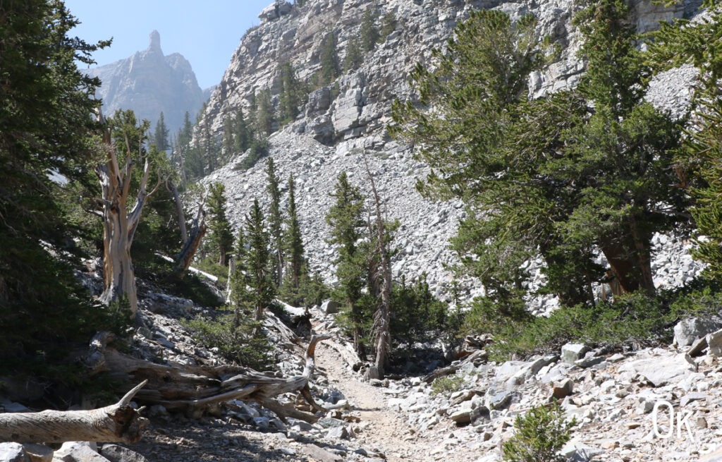
Starting from the parking lot, locate the trailhead sign and enter the forest with a mix of Englemann spruce and quaking aspen. Follow the signs for the Bristlecone Trail. Around a quarter mile in, you have the option to add the 2 mile Alpine Lakes loop to your journey. This loop circles back to the main path and is a great addition if you have the time. If you prefer to stay on the direct route, continue following the red tabs marked on the trees. The path maintains a gentle incline as it climbs toward the interpretive trail, eventually gaining about 600 feet in elevation.
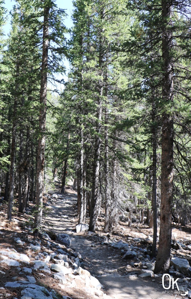
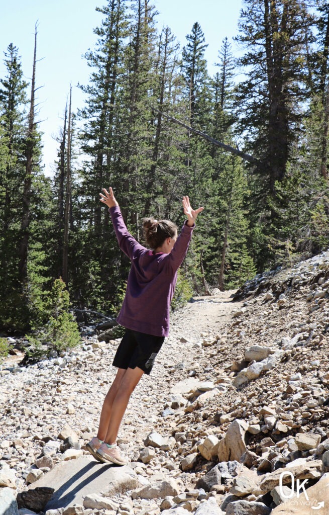
The dirt path becomes rocky and is fairly exposed even with the trees around.
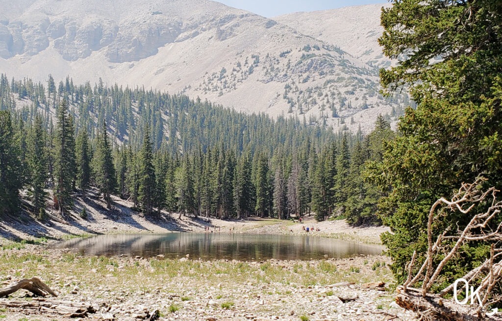
A short detour off the main trail takes you to Teresa Lake.
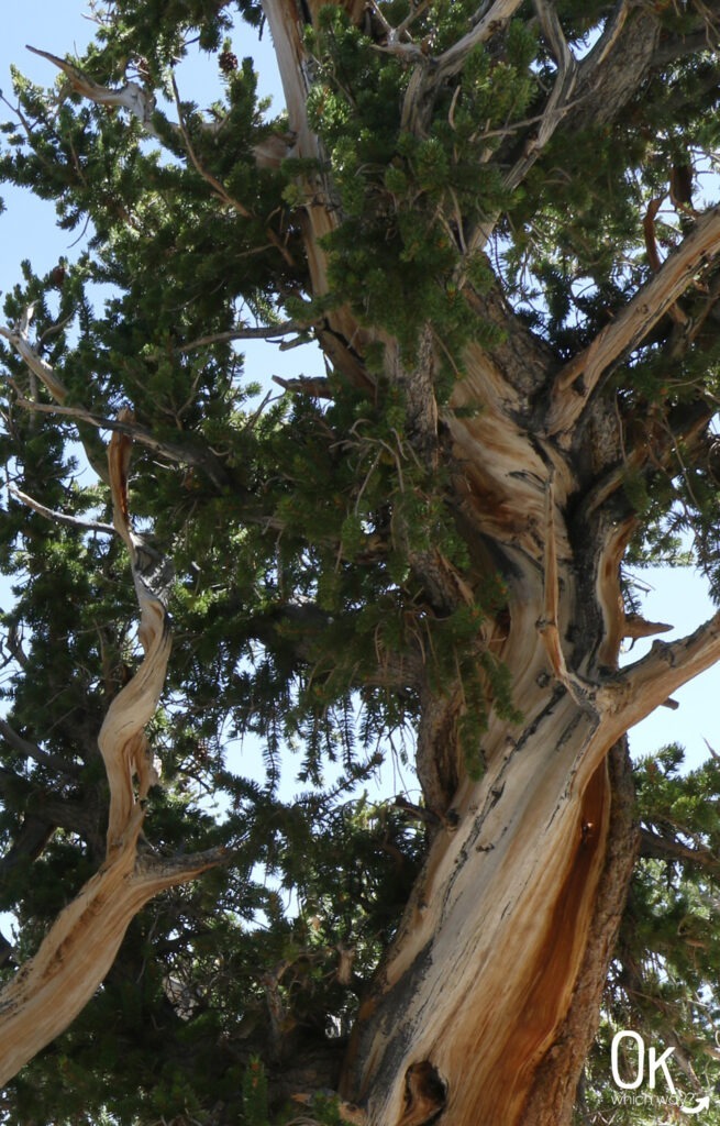
As the trail continues, you start to see the bristlecone pines. Both bristlecone and limber pines grow here just below the tree line. Limber pines are gnarly trees that grow at high elevation and are often confused with bristlecone pines. To tell them apart, look at the needles and cones. Bristlecone needles grow uniformly down the branch about a foot, giving it the appearance of a bottle brush, and their cones have distinct bristles. In contrast, limber pine needles grow in clusters at the ends of the branches, and their cones do not have bristles.
Bristlecone Pine Interpretive Trail Loop
After walking about a mile and a half from the trailhead, veer off the main trail to follow the interpretive path. The interpretive signs along the loop provide information about bristlecone pines, as well as stats about when specific trees lived and died. Some are over 4000 years old!
The Resilience of the Bristlecone
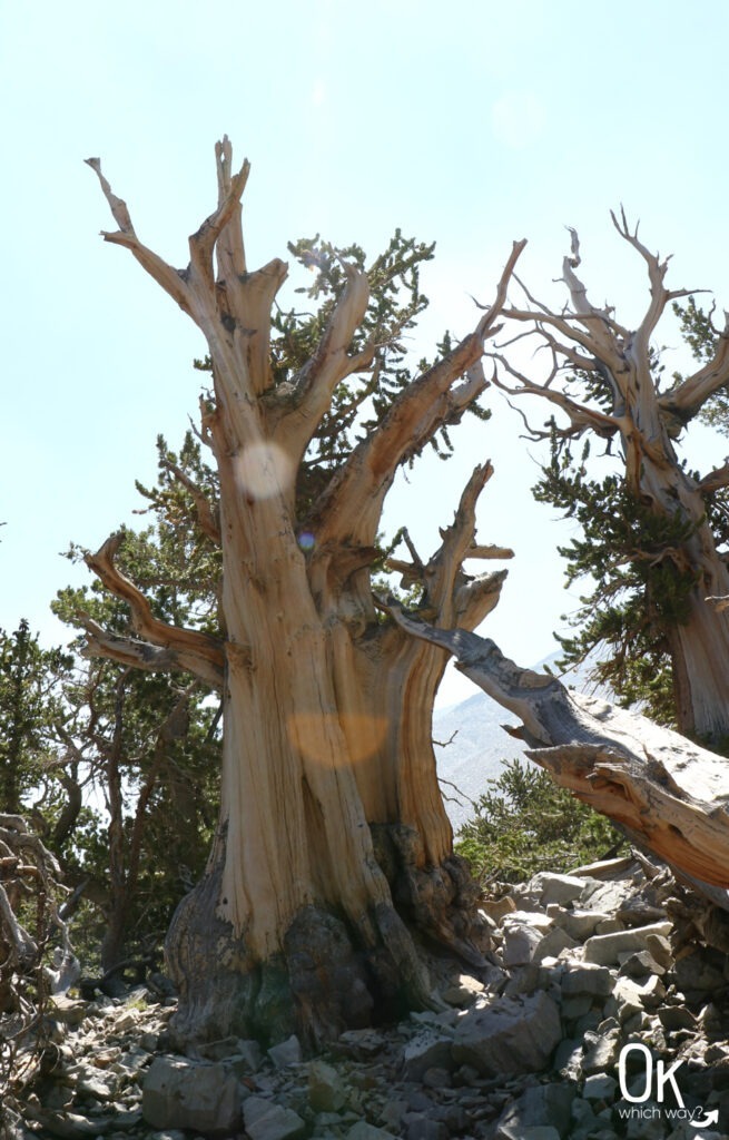
The gnarly shapes of these trees are a result of surviving high winds and a short growing season that twists the wood into contorted and beautiful forms.
-
Dense Wood: Because they grow so slowly, their wood is incredibly dense. This provides a natural resistance to insects, fungi, and rot.
-
Erosion vs. Decay: Instead of rotting after death, the wood is eroded and polished by the elements, allowing dead trees to remain standing for thousands of years.
-
Sectioned Survival: The trees can section off parts of their root system allowing one part of the tree to remain living even when a different section dies.
Return to the Trailhead or Continue to the Glacier
From the interpretive loop, you have the option to turn around and head back to the trailhead or continue along the trail about a mile to see the only glacier in Nevada.
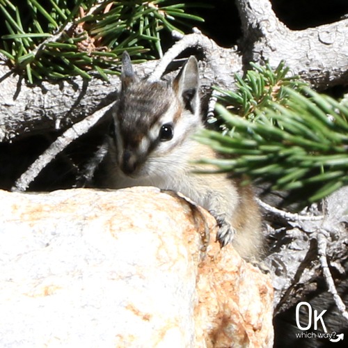
Wildlife Sightings
We didn’t see much wildlife during our short time at Great Basin. But, we did see wild turkeys along Baker Creek Road and this chipmunk during our hike. Other mammals found in the area are mule deer, bobcats, kangaroo rats, and a number of species of bats.
Final Thoughts
I am amazed by bristlecone pine trees and their ability to adapt and outlast nearly everything else on Earth. Also, they are just so cool looking. Having the opportunity to walk through a grove of them was a highlight of the trip. If you like unique trees as much as I do, this hike is a must.
LEAVE NO TRACE
Optional Items to Bring
More Locations to See Bristlecone Pines
- Inyo National Forest in California
- Death Valley National Park in California
- Spring Mountains National Recreational Area near Las Vegas
- Bryce Canyon National Park in Utah
- Cedar Breaks National Monument in Utah
- Dixie National Forest near Zion
- A small bristlecone can be seen at Hoyt Arboretum in Portland, Oregon
Our Stats
Date: August 2021
Distance: 3.2 miles
Start: Bristlecone Trailhead
End: Bristlecone Trailhead
Hiking Time: 2hrs 20min*
Air Quality: Drifting smoke from regional wildfires did have a negative impact on the air quality during our hike
*A quick note on our hiking style – We stop and smell the roses. When I go for a run, speed is a consideration. While hiking, it is not. We take photos, watch the chipmunk, find geocaches, and simply enjoy the adventure. So, typically a hike can be completed in a shorter time than we log.
International Dark Sky Park ✬彡
Great Basin National Park has exceptional starry nights and is a designated International Dark Sky Park.
Thinking About Hiking the Bristlecone Trail in Great Basin National Park?
Pin This to Help Plan Your Trip ⬇
More National Park Sites to Explore in the Southwest
This trail review is based only on Jennifer’s experience. Hike at your own risk with the understanding that individual scenarios in a natural environment will be variable.